






Cornwall National Landscape (AONB) by Train
Photo: Werner Wilmes, CC BY 2.0, via Wikimedia Commons
Cornwall's protected landscape runs from granite moorland to dramatic sea cliffs, with Brown Willy and Rough Tor rising over Bodmin Moor and the coast path linking hidden coves, fishing harbours and headlands. Falmouth, Looe and St Ives stations give train access to coastal walks.
There are 17 stations in or within 2 miles of Cornwall National Landscape.
The area is home to 151 DoBIH-listed peaks, the highest being Brown Willy at 420m.
A National Trail passes through or near the area: South West Coast Path.
Cornwall National Landscape train stations
Best for walkers first: gold, silver and bronze rate the hills, landscape and trails near each.
- Par0.7 mi (about 0.9 to 1 mi on foot)Bronze walking rating
- St Ives (Cornwall)0.7 mi (about 0.8 to 0.9 mi on foot)Bronze walking rating
- St Erth0.9 mi (about 1 mi on foot)Bronze walking rating
- Penzance0.9 mi (about 1 mi on foot)Bronze walking rating
- Lelant Saltings1.1 mi (about 1.5 mi on foot)Bronze walking rating
- Carbis Bay1.2 mi (about 1.5 mi on foot)Bronze walking rating
- Lelant1.4 mi (about 1.5 to 2 mi on foot)Bronze walking rating
- Penmere0.8 mi (about 1 mi on foot)Bronze walking rating
- Falmouth Town0.8 mi (about 1 mi on foot)Bronze walking rating
- Falmouth Docks0.6 mi (about 0.7 to 0.8 mi on foot) · closestBronze walking rating
- Looe0.8 mi (about 1 mi on foot)Bronze walking rating
- Lostwithiel1.2 mi (about 1.5 mi on foot)
- St Austell1.2 mi (about 1.5 mi on foot)
- Perranwell0.6 mi (about 0.8 to 0.9 mi on foot)
- Penryn0.8 mi (about 1 mi on foot)
- Camborne1.8 mi (about 2 to 2.5 mi on foot)
- Truro1.2 mi (about 1.5 mi on foot)
Walking distances are estimates from the straight-line distance and the type of ground, not a measured route. Check a map before you set off.
Journey times from cities
How soon you can be at the nearest station serving the Cornwall National Landscape from each city, counting stations just outside the boundary as well as inside it.
- Plymouth to LostwithielFrom 48min
- Exeter to LostwithielFrom 1hr 50min
- Bristol to LostwithielFrom 2hr 57min
- Bath to LostwithielFrom 3hr 20min
- London to ParFrom 4hr 1min
- Oxford to ParFrom 4hr 10min
- Cardiff to LostwithielFrom 4hr 15min
- Southampton to ParFrom 4hr 45min
- Birmingham to ParFrom 4hr 51min
- Swansea to LostwithielFrom 5hr 21min
- Cambridge to ParFrom 5hr 24min
- Leicester to LostwithielFrom 5hr 28min
- Brighton to ParFrom 5hr 36min
- Nottingham to LostwithielFrom 6hr 8min
- Sheffield to LostwithielFrom 6hr 8min
- Manchester to ParFrom 6hr 28min
- Norwich to ParFrom 6hr 34min
- York to LostwithielFrom 6hr 44min
- Liverpool to LostwithielFrom 6hr 45min
- Leeds to ParFrom 6hr 48min
- Preston to LostwithielFrom 7hr
- Lancaster to LostwithielFrom 7hr 20min
Good to know
Can you get to the Cornwall National Landscape by train?
Yes. 17 stations are within 2 miles of the Cornwall National Landscape, including Falmouth Docks and Perranwell.
What is the nearest train station to the Cornwall National Landscape?
Falmouth Docks, 0.6 miles away (about 0.7 to 0.8 miles on foot) from the Cornwall National Landscape.
How long does it take to get to the Cornwall National Landscape by train?
The Cornwall National Landscape is 48min from Plymouth, 1hr 50min from Exeter, 2hr 57min from Bristol and 4hr 1min from London by train, to the nearest station.
More of Cornwall National Landscape
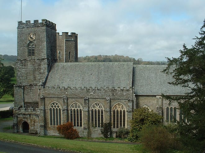
Photo: Necrothesp at English Wikipedia, CC BY-SA 3.0, via Wikimedia Commons
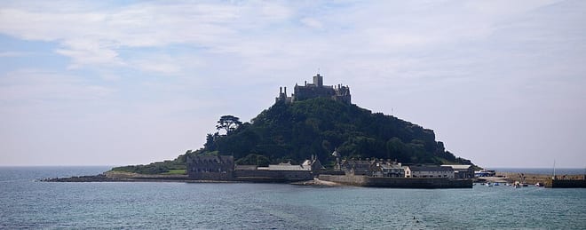
Photo: Ucred, CC BY-SA 3.0, via Wikimedia Commons
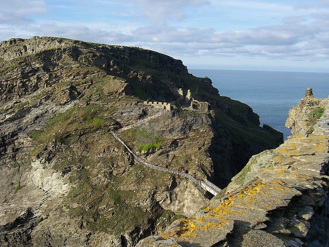
Photo: Wikimedia Commons contributor, Public domain, via Wikimedia Commons