





Long-Distance Trails by Train
You don’t need a car, or a fortnight, to walk a long-distance trail. These are the 16 National Trails of England and Wales and 28 of Scotland’s Great Trails, from the Pennine Way and the South West Coast Path to the West Highland Way. Stations sit along most of them, so you can walk one stretch at a time and take the train home.
Pick a trail for its stations and day walks, or sort the table below to find the stations closest to a route.
16 National Trails
All National Trails →


28 of Scotland's Great Trails
All of Scotland's Great Trails →






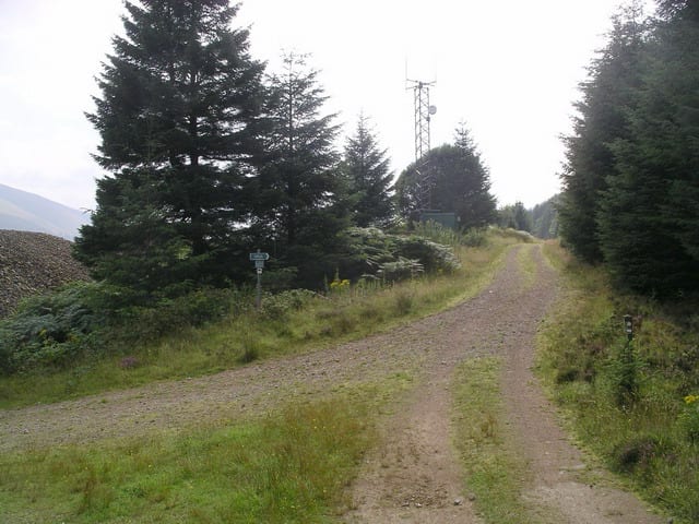


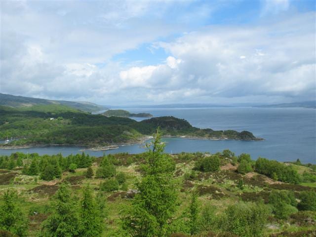

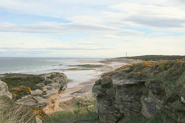
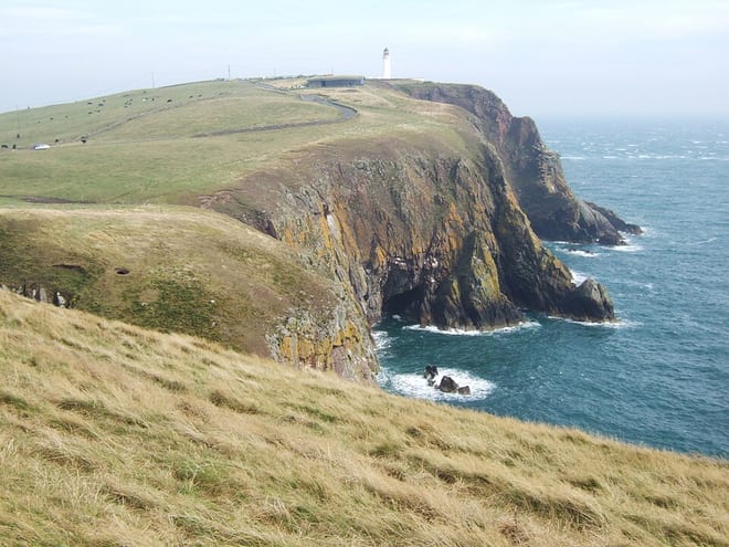




325 train stations
Best for walkers first: gold, silver and bronze rate the hills, landscape and trails near each.
- Arrochar & TarbetThree Lochs Way · 0.1 mi (about 0.1 mi on foot)Gold walking rating
- Tyndrum LowerWest Highland Way · 0.1 mi (about 0.1 mi on foot)Gold walking rating
- CrianlarichWest Highland Way · 0.5 mi (about 0.7 mi on foot)Gold walking rating
- Bridge of OrchyWest Highland WayGold walking rating
- ArdluiWest Highland Way · 0.6 mi (about 0.8 to 0.9 mi on foot)Gold walking rating
- MachynllethGlyndŵr's Way · 0.4 mi (about 0.4 to 0.5 mi on foot)Gold walking rating
- EdalePennine Way · 0.4 mi (about 0.4 to 0.5 mi on foot)Gold walking rating
- Fort WilliamWest Highland Way · 0.1 mi (about 0.1 mi on foot)Gold walking rating
- DentPennine Bridleway · 0.8 mi (about 1 mi on foot)Gold walking rating
- GarsdalePennine Bridleway · 0.1 mi (about 0.1 mi on foot)Gold walking rating
- Horton-in-RibblesdalePennine Way · 0.3 mi (about 0.3 mi on foot)Gold walking rating
- Dove HolesPennine Bridleway · 2.2 mi (about 2.5 to 3 mi on foot)Gold walking rating
- Kirkby StephenCoast to Coast · 0.6 mi (about 0.7 to 0.8 mi on foot)Gold walking rating
- HadfieldPennine Bridleway · 0.4 mi (about 0.5 mi on foot)Gold walking rating
- GarelochheadThree Lochs Way · 0.6 mi (about 0.7 to 0.8 mi on foot)Gold walking rating
- DintingPennine Bridleway · 0.4 mi (about 0.5 mi on foot)Gold walking rating
- ChinleyPennine Bridleway · 1.7 mi (about 2 to 2.5 mi on foot)Gold walking rating
- BanavieGreat Glen Way · 0.1 mi (about 0.1 mi on foot)Gold walking rating
- NewtonmoreSpeyside Way · 0.5 mi (about 0.5 to 0.6 mi on foot)Gold walking rating
- RibbleheadPennine Way · 2.2 mi (about 2.5 to 3 mi on foot)Gold walking rating
- KingussieSpeyside WayGold walking rating
- New Mills CentralPennine Bridleway · 1.7 mi (about 2 to 2.5 mi on foot)Gold walking rating
- SettlePennine Bridleway · 0.2 mi (about 0.3 mi on foot)Gold walking rating
- ApplebyPennine Way · 2.6 mi (about 3 to 3.5 mi on foot)Gold walking rating
- BroadbottomPennine Bridleway · 1.1 mi (about 1.5 mi on foot)Gold walking rating
- Helensburgh UpperJohn Muir WayGold walking rating
- Helensburgh CentralThree Lochs WayGold walking rating
- GreenfieldPennine Bridleway · 0.3 mi (about 0.3 to 0.4 mi on foot)Gold walking rating
- Mossley (Manchester)Pennine Bridleway · 0.8 mi (about 1 mi on foot)Gold walking rating
- PitlochryRob Roy Way · 0.1 mi (about 0.2 mi on foot)Gold walking rating
- AbergavennyOffa's Dyke Path · 4.6 mi (about 5.5 to 6 mi on foot)Silver walking rating
- KnightonOffa's Dyke Path · 0.3 mi (about 0.3 to 0.4 mi on foot)Silver walking rating
- MarsdenPennine Way · 1.8 mi (about 2 to 2.5 mi on foot)Silver walking rating
- Spean BridgeGreat Glen Way · 3.2 mi (about 4 to 4.5 mi on foot)Silver walking rating
- BallochJohn Muir WaySilver walking rating
- GargravePennine Way · 0.2 mi (about 0.2 mi on foot)Silver walking rating
- Clapham (N Yorks)Pennine Bridleway · 1.5 mi (about 2 mi on foot)Silver walking rating
- AviemoreSpeyside WaySilver walking rating
- Long PrestonPennine Bridleway · 0.2 mi (about 0.2 mi on foot)Silver walking rating
- KnucklasGlyndŵr's Way · 1.0 mi (about 1 to 1.5 mi on foot)Silver walking rating
- CromfordPennine Bridleway · 2.2 mi (about 2.5 to 3 mi on foot)Silver walking rating
- CraigendoranThree Lochs Way · 0.1 mi (about 0.2 mi on foot)Silver walking rating
- St BeesCoast to Coast · 0.5 mi (about 0.6 to 0.7 mi on foot)Silver walking rating
- TweedbankSouthern Upland WaySilver walking rating
- KildaleCleveland Way · 0.1 mi (about 0.1 to 0.2 mi on foot)Silver walking rating
- HellifieldPennine Bridleway · 1.3 mi (about 1.5 mi on foot)Silver walking rating
- CarrbridgeSpeyside Way · 3.5 mi (about 4 to 4.5 mi on foot)Silver walking rating
- CorkickleCoast to Coast · 1.6 mi (about 2 mi on foot)Silver walking rating
- BraystonesCoast to Coast · 4.3 mi (about 5 to 6 mi on foot)Silver walking rating
- LlangynlloGlyndŵr's Way · 0.3 mi (about 0.4 to 0.5 mi on foot)Silver walking rating
- CononleyPennine Way · 2.1 mi (about 2.5 to 3 mi on foot)Silver walking rating
- SoutheaseSouth Downs WaySilver walking rating
- Pen-y-BontGlyndŵr's Way · 4.3 mi (about 5 to 6 mi on foot)Silver walking rating
- Great AytonCleveland Way · 1.1 mi (about 1.5 mi on foot)Silver walking rating
- BattersbyCleveland Way · 1.2 mi (about 1.5 mi on foot)Silver walking rating
- HaltwhistlePennine Way · 1.8 mi (about 2 to 2.5 mi on foot)Bronze walking rating
- Llanbister RoadGlyndŵr's Way · 1.4 mi (about 1.5 to 2 mi on foot)Bronze walking rating
- Fishguard & GoodwickPembrokeshire Coast · 0.1 mi (about 0.1 mi on foot)Bronze walking rating
- SaltburnCleveland Way · 0.1 mi (about 0.2 mi on foot)Bronze walking rating
- AmberleySouth Downs Way · 0.3 mi (about 0.3 to 0.4 mi on foot)Bronze walking rating
- KingsknoweForth and Clyde and Union Canal TowpathBronze walking rating
- SlatefordJohn Muir Way · 0.2 mi (about 0.2 mi on foot)Bronze walking rating
- LargsAyrshire Coastal Path · 0.1 mi (about 0.1 to 0.2 mi on foot)Bronze walking rating
- SanquharSouthern Upland Way · 0.3 mi (about 0.3 to 0.4 mi on foot)Bronze walking rating
- WelshpoolGlyndŵr's Way · 0.2 mi (about 0.3 mi on foot)Bronze walking rating
- Bardon MillHadrian's Wall Path · 2.2 mi (about 2.5 to 3 mi on foot)Bronze walking rating
- PenallyPembrokeshire CoastBronze walking rating
- GrosmontCoast to CoastBronze walking rating
- GlaisdaleCoast to Coast · 0.1 mi (about 0.1 mi on foot)Bronze walking rating
- Milford HavenPembrokeshire Coast · 0.1 mi (about 0.1 mi on foot)Bronze walking rating
- EgtonCoast to Coast · 0.1 mi (about 0.1 mi on foot)Bronze walking rating
- Pembroke DockPembrokeshire Coast · 0.1 mi (about 0.2 mi on foot)Bronze walking rating
- WhitbyCleveland Way · 0.2 mi (about 0.2 mi on foot)Bronze walking rating
- TenbyPembrokeshire Coast · 0.2 mi (about 0.2 to 0.3 mi on foot)Bronze walking rating
- ScarboroughCleveland Way · 0.4 mi (about 0.4 to 0.5 mi on foot)Bronze walking rating
- PembrokePembrokeshire Coast · 0.6 mi (about 0.7 to 0.8 mi on foot)Bronze walking rating
- WinchesterSouth Downs Way · 0.7 mi (about 0.8 to 0.9 mi on foot)Bronze walking rating
- HaymarketJohn Muir Way · 0.4 mi (about 0.5 to 0.6 mi on foot)Bronze walking rating
- CooksbridgeSouth Downs Way · 2.0 mi (about 2.5 mi on foot)Bronze walking rating
- GlyndeSouth Downs Way · 1.7 mi (about 2 to 2.5 mi on foot)Bronze walking rating
- Berwick (Sussex)South Downs Way · 2.0 mi (about 2.5 mi on foot)Bronze walking rating
- SeafordSouth Downs Way · 2.3 mi (about 3 mi on foot)Bronze walking rating
- Goring & StreatleyThe Ridgeway · 0.3 mi (about 0.3 to 0.4 mi on foot)Bronze walking rating
- CholseyThames Path · 0.9 mi (about 1 to 1.5 mi on foot)Bronze walking rating
- Brampton (Cumbria)Hadrian's Wall Path · 2.8 mi (about 3.5 mi on foot)Bronze walking rating
- DanbyCoast to Coast · 3.4 mi (about 4 to 4.5 mi on foot)Bronze walking rating
- PetersfieldSouth Downs Way · 2.4 mi (about 3 to 3.5 mi on foot)Bronze walking rating
- ParSouth West Coast Path · 0.3 mi (about 0.4 mi on foot)Bronze walking rating
- KirkconnelSouthern Upland Way · 3.0 mi (about 3.5 to 4 mi on foot)Bronze walking rating
- ChirkOffa's Dyke Path · 1.3 mi (about 1.5 mi on foot)Bronze walking rating
- FalmerSouth Downs Way · 1.3 mi (about 1.5 to 2 mi on foot)Bronze walking rating
- HassocksSouth Downs Way · 1.4 mi (about 1.5 to 2 mi on foot)Bronze walking rating
- EastbourneSouth Downs Way · 1.4 mi (about 1.5 to 2 mi on foot)Bronze walking rating
- SaundersfootPembrokeshire Coast · 1.0 mi (about 1 to 1.5 mi on foot)Bronze walking rating
- ChepstowOffa's Dyke Path · 0.3 mi (about 0.4 mi on foot)Bronze walking rating
- PrestatynOffa's Dyke PathBronze walking rating
- BetchworthNorth Downs Way · 0.2 mi (about 0.2 mi on foot)Bronze walking rating
- Box Hill & WesthumbleNorth Downs Way · 0.2 mi (about 0.3 mi on foot)Bronze walking rating
- ChilworthNorth Downs Way · 0.7 mi (about 0.8 to 0.9 mi on foot)Bronze walking rating
- GomshallNorth Downs Way · 0.7 mi (about 0.9 to 1 mi on foot)Bronze walking rating
- MersthamNorth Downs Way · 0.1 mi (about 0.2 mi on foot)Bronze walking rating
- OxtedNorth Downs Way · 0.9 mi (about 1 to 1.5 mi on foot)Bronze walking rating
- TringThe RidgewayBronze walking rating
- WendoverThe Ridgeway · 0.1 mi (about 0.1 mi on foot)Bronze walking rating
- Princes RisboroughThe Ridgeway · 0.4 mi (about 0.5 mi on foot)Bronze walking rating
- Little KimbleThe Ridgeway · 0.9 mi (about 1 mi on foot)Bronze walking rating
- LelantSouth West Coast PathBronze walking rating
- Carbis BaySouth West Coast PathBronze walking rating
- St Ives (Cornwall)South West Coast PathBronze walking rating
- PenzanceSouth West Coast PathBronze walking rating
- GalashielsSouthern Upland Way · 0.4 mi (about 0.4 to 0.5 mi on foot)Bronze walking rating
- CuxtonNorth Downs Way · 0.4 mi (about 0.5 mi on foot)Bronze walking rating
- HarrietshamNorth Downs Way · 0.6 mi (about 0.7 to 0.8 mi on foot)Bronze walking rating
- HollingbourneNorth Downs Way · 0.7 mi (about 0.8 to 0.9 mi on foot)Bronze walking rating
- LenhamNorth Downs Way · 0.8 mi (about 1 mi on foot)Bronze walking rating
- HallingNorth Downs Way · 0.9 mi (about 1 mi on foot)Bronze walking rating
- StalybridgePennine Bridleway · 1.8 mi (about 2 to 2.5 mi on foot)Bronze walking rating
- ForresMoray Coast Trail · 0.4 mi (about 0.5 to 0.6 mi on foot)Bronze walking rating
- CroyJohn Muir Way · 0.5 mi (about 0.6 mi on foot)Bronze walking rating
- ManorbierPembrokeshire Coast · 1.2 mi (about 1.5 mi on foot)Bronze walking rating
- LampheyPembrokeshire Coast · 1.5 mi (about 1.5 to 2 mi on foot)Bronze walking rating
- SleightsCoast to Coast · 2.0 mi (about 2.5 mi on foot)Bronze walking rating
- Johnston (Pembrokeshire)Pembrokeshire Coast · 2.8 mi (about 3.5 to 4 mi on foot)Bronze walking rating
- HexhamHadrian's Wall Path · 3.2 mi (about 4 to 4.5 mi on foot)Bronze walking rating
- NorthallertonCoast to Coast · 3.4 mi (about 4 to 4.5 mi on foot)Bronze walking rating
- SeamerYorkshire Wolds Way · 3.8 mi (about 4.5 to 5 mi on foot)Bronze walking rating
- KirknewtonCross Borders Drove Road · 2.6 mi (about 3 to 3.5 mi on foot)Bronze walking rating
- OtfordNorth Downs WayBronze walking rating
- TilehurstThames PathBronze walking rating
- ShiplakeThames PathBronze walking rating
- WyeNorth Downs WayBronze walking rating
- Falmouth DocksSouth West Coast Path · 0.1 mi (about 0.1 mi on foot)Bronze walking rating
- Henley-on-ThamesThames Path · 0.1 mi (about 0.2 mi on foot)Bronze walking rating
- Bourne EndThames Path · 0.2 mi (about 0.2 mi on foot)Bronze walking rating
- MarlowThames Path · 0.2 mi (about 0.2 to 0.3 mi on foot)Bronze walking rating
- LooeSouth West Coast Path · 0.2 mi (about 0.3 mi on foot)Bronze walking rating
- CromerPeddars Way and Norfolk Coast Path · 0.2 mi (about 0.3 mi on foot)Bronze walking rating
- Dover PrioryNorth Downs Way · 0.2 mi (about 0.3 mi on foot)Bronze walking rating
- PangbourneThames Path · 0.2 mi (about 0.3 mi on foot)Bronze walking rating
- SheringhamPeddars Way and Norfolk Coast Path · 0.2 mi (about 0.3 mi on foot)Bronze walking rating
- Bath SpaCotswold Way · 0.3 mi (about 0.3 mi on foot)Bronze walking rating
- Shepherds WellNorth Downs Way · 0.3 mi (about 0.3 to 0.4 mi on foot)Bronze walking rating
- BekesbourneNorth Downs Way · 0.3 mi (about 0.4 to 0.5 mi on foot)Bronze walking rating
- KembleThames Path · 0.4 mi (about 0.5 mi on foot)Bronze walking rating
- ExmouthSouth West Coast Path · 0.4 mi (about 0.5 mi on foot)Bronze walking rating
- West RuntonPeddars Way and Norfolk Coast Path · 0.4 mi (about 0.5 to 0.6 mi on foot)Bronze walking rating
- StonehouseCotswold Way · 0.5 mi (about 0.6 mi on foot)Bronze walking rating
- Dunton GreenNorth Downs Way · 0.5 mi (about 0.6 to 0.7 mi on foot)Bronze walking rating
- ChilhamNorth Downs Way · 0.5 mi (about 0.6 to 0.7 mi on foot)Bronze walking rating
- Charing (Kent)North Downs Way · 0.6 mi (about 0.7 to 0.8 mi on foot)Bronze walking rating
- CharthamNorth Downs Way · 0.7 mi (about 0.8 to 0.9 mi on foot)Bronze walking rating
- SnowdownNorth Downs Way · 0.8 mi (about 1 mi on foot)Bronze walking rating
- Shalford (Surrey)North Downs Way · 0.8 mi (about 1 mi on foot)Bronze walking rating
- PlymouthSouth West Coast Path · 0.8 mi (about 1 mi on foot)Bronze walking rating
- ReigateNorth Downs Way · 0.8 mi (about 1 mi on foot)Bronze walking rating
- Folkestone WestNorth Downs Way · 0.9 mi (about 1 to 1.5 mi on foot)Bronze walking rating
- PolmontJohn Muir Way · 0.1 mi (about 0.1 mi on foot)
- InvernessGreat Glen Way · 0.3 mi (about 0.3 to 0.4 mi on foot)
- MilngavieWest Highland Way · 0.1 mi (about 0.2 mi on foot)
- Hebden BridgePennine Bridleway · 1.0 mi (about 1 to 1.5 mi on foot)
- Newton-on-AyrAyrshire Coastal Path · 0.1 mi (about 0.1 mi on foot)
- AyrRiver Ayr Way · 0.2 mi (about 0.2 mi on foot)
- WalsdenPennine Bridleway · 0.4 mi (about 0.5 to 0.6 mi on foot)
- LittleboroughPennine Bridleway · 0.8 mi (about 1 mi on foot)
- Smithy BridgePennine Bridleway · 0.9 mi (about 1 to 1.5 mi on foot)
- FairlieAyrshire Coastal Path · 0.2 mi (about 0.2 mi on foot)
- St AustellSouth West Coast Path · 1.4 mi (about 1.5 to 2 mi on foot)
- CaterhamNorth Downs Way · 1.2 mi (about 1.5 mi on foot)
- KnockholtNorth Downs Way · 2.4 mi (about 3 mi on foot)
- CamborneSouth West Coast Path · 2.6 mi (about 3 to 3.5 mi on foot)
- BrunstaneJohn Muir Way · 0.1 mi (about 0.1 mi on foot)
- AxminsterSouth West Coast Path · 4.3 mi (about 5 to 6 mi on foot)
- BearstedNorth Downs Way · 1.3 mi (about 1.5 to 2 mi on foot)
- MarkinchFife Coastal Path · 3.8 mi (about 4.5 to 5 mi on foot)
- LockerbieAnnandale Way · 0.1 mi (about 0.1 mi on foot)
- Falkirk HighJohn Muir Way
- FileyYorkshire Wolds Way
- KilwinningAyrshire Coastal Path · 0.8 mi (about 1 mi on foot)
- West KilbrideAyrshire Coastal Path · 0.9 mi (about 1 mi on foot)
- KelvindaleForth and Clyde and Union Canal Towpath
- WestertonForth and Clyde and Union Canal Towpath · 0.1 mi (about 0.1 mi on foot)
- ClydebankForth and Clyde and Union Canal Towpath · 0.2 mi (about 0.2 mi on foot)
- KilpatrickForth and Clyde and Union Canal Towpath · 0.2 mi (about 0.3 mi on foot)
- BowlingForth and Clyde and Union Canal Towpath · 0.4 mi (about 0.5 to 0.6 mi on foot)
- Stroud (Glos)Cotswold Way · 1.1 mi (about 1.5 mi on foot)
- KemsingNorth Downs Way · 1.2 mi (about 1.5 mi on foot)
- UpweySouth West Coast Path · 1.2 mi (about 1.5 mi on foot)
- Borough Green & WrothamNorth Downs Way · 1.3 mi (about 1.5 mi on foot)
- SandlingNorth Downs Way · 1.5 mi (about 2 mi on foot)
- WanboroughNorth Downs Way · 1.5 mi (about 2 mi on foot)
- SaundertonThe Ridgeway · 1.5 mi (about 2 mi on foot)
- Martin MillNorth Downs Way · 1.6 mi (about 2 mi on foot)
- KearsneyNorth Downs Way · 1.7 mi (about 2 to 2.5 mi on foot)
- FarncombeNorth Downs Way · 1.7 mi (about 2 to 2.5 mi on foot)
- St GermansSouth West Coast Path · 2.2 mi (about 2.5 to 3 mi on foot)
- Sole StreetNorth Downs Way · 2.3 mi (about 3 mi on foot)
- CorbridgeHadrian's Wall Path · 3.1 mi (about 3.5 to 4 mi on foot)
- MaltonYorkshire Wolds Way · 4.7 mi (about 5.5 to 6.5 mi on foot)
- InvergowrieFife Coastal Path · 2.9 mi (about 3.5 to 4 mi on foot)
- RosythFife Coastal Path · 0.8 mi (about 1 mi on foot)
- ColnePennine Bridleway · 2.4 mi (about 3 to 3.5 mi on foot)
- BarrhillSouthern Upland Way · 4.9 mi (about 6 to 6.5 mi on foot)
- LinlithgowForth and Clyde and Union Canal Towpath · 0.1 mi (about 0.1 mi on foot)
- GirvanAyrshire Coastal Path · 0.3 mi (about 0.3 to 0.4 mi on foot)
- PrestwickAyrshire Coastal Path · 0.2 mi (about 0.2 to 0.3 mi on foot)
- RochdalePennine Bridleway · 2.3 mi (about 2.5 to 3 mi on foot)
- DyceFormartine and Buchan Way · 0.1 mi (about 0.1 mi on foot)
- Glenrothes with ThorntonFife Coastal Path · 2.0 mi (about 2.5 mi on foot)
- LeucharsFife Coastal Path · 0.3 mi (about 0.3 to 0.4 mi on foot)
- Berwick-upon-TweedBerwickshire Coastal Path · 0.5 mi (about 0.6 to 0.7 mi on foot)
- North BerwickJohn Muir Way · 0.1 mi (about 0.2 mi on foot)
- East LintonJohn Muir Way · 0.2 mi (about 0.3 mi on foot)
- StranraerMull of Galloway Trail · 0.6 mi (about 0.7 to 0.8 mi on foot)
- ElginMoray Coast Trail · 5.0 mi (about 6 to 6.5 mi on foot)
- GobowenOffa's Dyke Path · 3.0 mi (about 3.5 to 4 mi on foot)
- StarcrossSouth West Coast Path
- Ardrossan TownAyrshire Coastal Path
- DawlishSouth West Coast Path
- NewquaySouth West Coast Path
- StevenstonAyrshire Coastal Path
- IrvineAyrshire Coastal Path
- KinghornFife Coastal Path
- WappingThames Path
- Dawlish WarrenSouth West Coast Path · 0.1 mi (about 0.1 mi on foot)
- Hampton CourtThames Path · 0.1 mi (about 0.1 mi on foot)
- Windsor & Eton RiversideThames Path · 0.1 mi (about 0.1 mi on foot)
- AberdourFife Coastal Path · 0.1 mi (about 0.1 mi on foot)
- FarnhamNorth Downs Way · 0.1 mi (about 0.1 mi on foot)
- OxfordThames Path · 0.1 mi (about 0.1 mi on foot)
- WeymouthSouth West Coast Path · 0.1 mi (about 0.1 mi on foot)
- SaltcoatsAyrshire Coastal Path · 0.1 mi (about 0.1 mi on foot)
- HessleYorkshire Wolds Way · 0.1 mi (about 0.1 to 0.2 mi on foot)
- BlantyreClyde Walkway · 0.1 mi (about 0.1 to 0.2 mi on foot)
- TorquaySouth West Coast Path · 0.1 mi (about 0.2 mi on foot)
- TeignmouthSouth West Coast Path · 0.1 mi (about 0.2 mi on foot)
- DatchetThames Path · 0.1 mi (about 0.2 mi on foot)
- Canterbury WestNorth Downs Way · 0.1 mi (about 0.2 mi on foot)
- BurntislandFife Coastal Path · 0.1 mi (about 0.2 mi on foot)
- North QueensferryFife Coastal Path · 0.2 mi (about 0.2 mi on foot)
- BarnstapleSouth West Coast Path · 0.2 mi (about 0.2 to 0.3 mi on foot)
- ReadingThames Path · 0.2 mi (about 0.3 mi on foot)
- InverkeithingFife Coastal Path · 0.2 mi (about 0.3 mi on foot)
- AnnanAnnandale Way · 0.2 mi (about 0.3 mi on foot)
- BarassieAyrshire Coastal Path · 0.2 mi (about 0.3 mi on foot)
- ManorsHadrian's Wall Path · 0.2 mi (about 0.3 mi on foot)
- TroonAyrshire Coastal Path · 0.3 mi (about 0.3 mi on foot)
- CambuslangClyde Walkway · 0.3 mi (about 0.3 mi on foot)
- PaigntonSouth West Coast Path · 0.3 mi (about 0.3 mi on foot)
- FerribyYorkshire Wolds Way · 0.3 mi (about 0.3 mi on foot)
- UddingstonClyde Walkway · 0.3 mi (about 0.4 mi on foot)
- AirblesClyde Walkway · 0.3 mi (about 0.4 mi on foot)
- DalmenyJohn Muir Way · 0.3 mi (about 0.4 mi on foot)
- ApplefordThames Path · 0.3 mi (about 0.4 to 0.5 mi on foot)
- DunbarJohn Muir Way · 0.3 mi (about 0.4 to 0.5 mi on foot)
- StainesThames Path · 0.4 mi (about 0.4 to 0.5 mi on foot)
- SheppertonThames Path · 0.5 mi (about 0.5 to 0.6 mi on foot)
- MetrocentreHadrian's Wall Path · 0.5 mi (about 0.6 mi on foot)
- KirkcaldyFife Coastal Path · 0.5 mi (about 0.6 mi on foot)
- HeworthHadrian's Wall Path · 0.6 mi (about 0.7 to 0.8 mi on foot)
- SunnymeadsThames Path · 0.6 mi (about 0.7 to 0.8 mi on foot)
- CarlisleHadrian's Wall Path · 0.6 mi (about 0.7 to 0.8 mi on foot)
- BlaydonHadrian's Wall Path · 0.7 mi (about 0.8 to 0.9 mi on foot)
- EghamThames Path · 0.7 mi (about 0.8 to 0.9 mi on foot)
- DunstonHadrian's Wall Path · 0.7 mi (about 0.9 to 1 mi on foot)
- RadleyThames Path · 0.7 mi (about 1 mi on foot)
- TaplowThames Path · 0.9 mi (about 1 mi on foot)
- AddlestoneThames Path · 0.9 mi (about 1 mi on foot)
- MaidenheadThames Path · 0.9 mi (about 1 mi on foot)
- WylamHadrian's Wall Path · 1.0 mi (about 1 to 1.5 mi on foot)
- DundeeFife Coastal Path · 1.5 mi (about 2 mi on foot)
- Hampden Park (Sussex)South Downs Way · 1.9 mi (about 2.5 mi on foot)
- LuxulyanSouth West Coast Path · 3.3 mi (about 4 to 4.5 mi on foot)
- Cheltenham SpaCotswold Way · 2.5 mi (about 3 to 3.5 mi on foot)
- MayboleAyrshire Coastal Path · 3.5 mi (about 4 to 4.5 mi on foot)
- Stoke MandevilleThe Ridgeway · 2.4 mi (about 3 to 3.5 mi on foot)
- CheddingtonThe Ridgeway · 2.5 mi (about 3 to 3.5 mi on foot)
- RedruthSouth West Coast Path · 3.3 mi (about 4 to 4.5 mi on foot)
- KeynshamCotswold Way · 3.1 mi (about 4 mi on foot)
- RochesterNorth Downs Way · 1.6 mi (about 2 mi on foot)
- SnodlandNorth Downs Way · 1.6 mi (about 2 mi on foot)
- AylesfordNorth Downs Way · 1.9 mi (about 2.5 mi on foot)
- Maidstone EastNorth Downs Way · 2.4 mi (about 3 mi on foot)
- PooleSouth West Coast Path · 3.1 mi (about 4 mi on foot)
- SunburyThames Path · 1.0 mi (about 1.5 mi on foot)
- Walton-on-ThamesThames Path · 1.1 mi (about 1.5 mi on foot)
- BroughYorkshire Wolds Way · 1.4 mi (about 1.5 to 2 mi on foot)
- EarleyThames Path · 1.7 mi (about 2 to 2.5 mi on foot)
- Oxford ParkwayThames Path · 1.7 mi (about 2 to 2.5 mi on foot)
- Quintrell DownsSouth West Coast Path · 1.8 mi (about 2 to 2.5 mi on foot)
- HunmanbyYorkshire Wolds Way · 1.9 mi (about 2.5 mi on foot)
- AshNorth Downs Way · 2.0 mi (about 2.5 mi on foot)
- Cam & DursleyCotswold Way · 2.0 mi (about 2.5 mi on foot)
- SturryNorth Downs Way · 2.1 mi (about 2.5 to 3 mi on foot)
- AldershotNorth Downs Way · 2.1 mi (about 2.5 to 3 mi on foot)
- TadworthNorth Downs Way · 2.3 mi (about 3 mi on foot)
- PrudhoeHadrian's Wall Path · 2.6 mi (about 3 to 3.5 mi on foot)
- AuchinleckRiver Ayr Way · 2.7 mi (about 3 to 3.5 mi on foot)
- Harling RoadPeddars Way and Norfolk Coast Path · 2.8 mi (about 3.5 mi on foot)
- YateCotswold Way · 3.3 mi (about 4 to 4.5 mi on foot)
- HoneybourneCotswold Way · 3.4 mi (about 4 to 4.5 mi on foot)
- BroomfleetYorkshire Wolds Way · 4.0 mi (about 5 to 5.5 mi on foot)
- KirkhaughPennine Way
- LevenFife Coastal Path
- Barnes BridgeThames Path
- Kew BridgeThames Path · 0.1 mi (about 0.1 mi on foot)
- London BlackfriarsThames Path · 0.1 mi (about 0.1 mi on foot)
- Battersea ParkThames Path · 0.1 mi (about 0.1 mi on foot)
- SlaggyfordPennine Way · 0.1 mi (about 0.1 mi on foot)
- Imperial WharfThames Path · 0.1 mi (about 0.1 mi on foot)
- VauxhallThames Path · 0.1 mi (about 0.1 to 0.2 mi on foot)
- Wandsworth TownThames Path · 0.1 mi (about 0.2 mi on foot)
- Glasgow Central Low LevelClyde Walkway · 0.2 mi (about 0.2 mi on foot)
- Hampton WickThames Path · 0.2 mi (about 0.3 mi on foot)
- PutneyThames Path · 0.3 mi (about 0.3 mi on foot)
- DalmarnockClyde Walkway · 0.3 mi (about 0.3 to 0.4 mi on foot)
- GreenwichThames Path · 0.3 mi (about 0.3 to 0.4 mi on foot)
- Strawberry HillThames Path · 0.3 mi (about 0.3 to 0.4 mi on foot)
- GilshochillForth and Clyde and Union Canal Towpath · 0.3 mi (about 0.3 to 0.4 mi on foot)
- BrentfordThames Path · 0.3 mi (about 0.4 mi on foot)
- Richmond (London)Thames Path · 0.4 mi (about 0.5 mi on foot)
- Hampton (London)Thames Path · 0.4 mi (about 0.5 to 0.6 mi on foot)
- CharltonThames Path · 0.5 mi (about 0.6 to 0.7 mi on foot)
- Kensington (Olympia)Thames Path · 1.0 mi (about 1 to 1.5 mi on foot)
- Cameron BridgeFife Coastal Path · 1.2 mi (about 1.5 mi on foot)
- Northumberland Park (Tyne & Wear)Hadrian's Wall Path · 3.1 mi (about 3.5 to 4 mi on foot)
Walking distances are estimates from the straight-line distance and the type of ground, not a measured route. Check a map before you set off.