






Photo: Neil Theasby, CC BY-SA 2.0, via Geograph
The Lincolnshire Wolds are a landscape of chalk hills, deep valleys, hedgerows and quiet villages, with Normanby Top, Pewlade Hill and Flint Hill among the high points and big skies over rolling farmland. Market Rasen station is the nearest railhead for Wolds walking.
There are 0 stations in or within 1 mile of Lincolnshire Wolds National Landscape.
The area is home to 10 DoBIH-listed peaks, the highest being Normanby Top [The Wolds] at 168m.
Lincolnshire Wolds National Landscape train stations
No stations found in or within 1 mile of Lincolnshire Wolds National Landscape.
Getting there without a car
No railway station lies within 1 mile of the Lincolnshire Wolds National Landscape, so the train only gets you part of the way. These are the nearest stations within 10 miles:
- Market Rasen2.6 mi (about 3 to 3.5 mi on foot)
- Healing3.5 mi (about 4 to 4.5 mi on foot)
- Great Coates3.7 mi (about 4.5 to 5 mi on foot)
- Stallingborough3.7 mi (about 4.5 to 5 mi on foot)
- Grimsby Town4.2 mi (about 5 to 5.5 mi on foot)
Walking distances are estimates from the straight-line distance and the type of ground, not a measured route. Check a map before you set off.
Good to know
Can you get to the Lincolnshire Wolds National Landscape by train?
Not directly. No station lies within 1 mile of the Lincolnshire Wolds National Landscape; the nearest is Market Rasen, 2.6 miles away (about 3 to 3.5 miles on foot).
More of Lincolnshire Wolds National Landscape
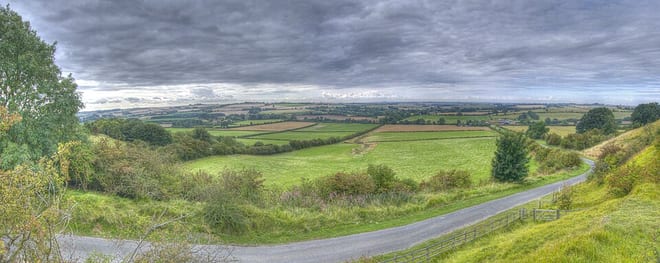
Photo: Shyamal, CC BY-SA 3.0, via Wikimedia Commons