






Photo: JKMMX, CC BY-SA 3.0, via Wikimedia Commons
Sea cliffs, hidden sandy coves and wildlife-rich headlands line the Pembrokeshire coast path, while heather hills rise inland to Foel Cwmcerwyn and Carn Menyn. Haverfordwest and nearby stations make this spectacular Welsh coastline a scenic, car-free walking destination.
There are 17 stations within 5 miles of Arfordir Penfro / Pembrokeshire Coast National Park.
The park area is home to 130 DoBIH-listed peaks, the highest being Foel Cwmcerwyn at 537m.
Pembrokeshire Coast train stations
Best for walkers first: gold, silver and bronze rate the hills, landscape and trails near each.
- Fishguard Harbour0.4 mi (about 0.5 mi on foot)Bronze walking rating
- Fishguard & Goodwick0.5 mi (about 0.6 to 0.7 mi on foot)Bronze walking rating
- Clunderwen4.1 mi (about 5 to 5.5 mi on foot)Bronze walking rating
- TenbyBronze walking rating
- PenallyBronze walking rating
- Milford Haven1.3 mi (about 1.5 to 2 mi on foot)Bronze walking rating
- Pembroke1.4 mi (about 1.5 to 2 mi on foot)Bronze walking rating
- Pembroke Dock1.7 mi (about 2 mi on foot)Bronze walking rating
- SaundersfootBronze walking rating
- Kilgetty0.3 mi (about 0.3 to 0.4 mi on foot)Bronze walking rating
- Narberth2.9 mi (about 3.5 to 4 mi on foot)Bronze walking rating
- Whitland4.6 mi (about 5.5 to 6.5 mi on foot)Bronze walking rating
- ManorbierBronze walking rating
- Lamphey0.2 mi (about 0.3 mi on foot)Bronze walking rating
- Haverfordwest1.3 mi (about 1.5 mi on foot)Bronze walking rating
- Johnston (Pembrokeshire)1.8 mi (about 2 to 2.5 mi on foot)Bronze walking rating
- Clarbeston Road3.3 mi (about 4 to 4.5 mi on foot)Bronze walking rating
Walking distances are estimates from the straight-line distance and the type of ground, not a measured route. Check a map before you set off.
Onward bus services
Buses that reach further into Arfordir Penfro / Pembrokeshire Coast than the stations above. Check the days each one runs before you travel.
Puffin Shuttle (400) / Strumble Shuttle (404)
From Haverfordwest station – a connecting bus outside the station reaches St Davids, where the coastal shuttles start
Daily, 23 May–27 September 2026
Timetable: pembrokeshirecoast.wales ↗
Journey times from cities
How soon you can be at the nearest station serving Arfordir Penfro / Pembrokeshire Coast National Park from each city, counting stations just outside the boundary as well as inside it.
- Swansea to WhitlandFrom 1hr 6min
- Cardiff to WhitlandFrom 2hr 9min
- Bristol to WhitlandFrom 3hr 8min
- Bath to WhitlandFrom 3hr 30min
- London to WhitlandFrom 4hr 6min
- Birmingham to WhitlandFrom 4hr 12min
- Oxford to WhitlandFrom 4hr 22min
- Exeter to WhitlandFrom 4hr 31min
- Southampton to WhitlandFrom 4hr 59min
- Leicester to WhitlandFrom 5hr 24min
- Plymouth to WhitlandFrom 5hr 31min
- Cambridge to WhitlandFrom 5hr 39min
- Brighton to WhitlandFrom 5hr 43min
- Manchester to WhitlandFrom 5hr 44min
- Preston to WhitlandFrom 5hr 56min
- Sheffield to WhitlandFrom 5hr 56min
- Nottingham to WhitlandFrom 6hr
- Liverpool to WhitlandFrom 6hr 3min
- Lancaster to WhitlandFrom 6hr 9min
- Norwich to WhitlandFrom 6hr 35min
- York to WhitlandFrom 6hr 45min
- Leeds to WhitlandFrom 6hr 55min
Good to know
Can you get to the Pembrokeshire Coast by train?
Yes. 17 stations are within 5 miles of the Pembrokeshire Coast, including Manorbier and Saundersfoot.
What is the nearest train station to the Pembrokeshire Coast?
4 stations with regular trains are inside the Pembrokeshire Coast, including Manorbier, Saundersfoot and Tenby.
How long does it take to get to the Pembrokeshire Coast by train?
The Pembrokeshire Coast is 1hr 40min from Swansea, 2hr 40min from Cardiff and 3hr 44min from Bristol by train, to the quickest station inside the park.
More of Arfordir Penfro / Pembrokeshire Coast
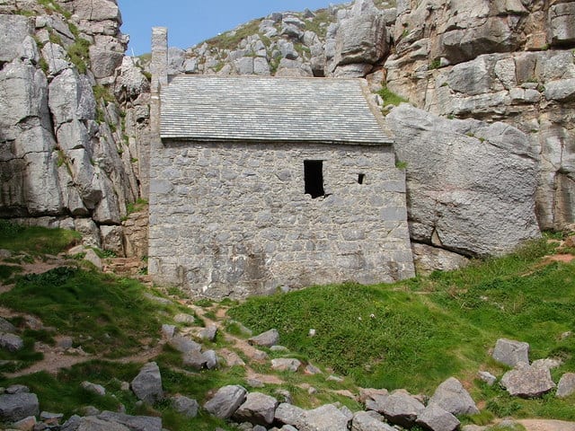
Photo: Anthony Gostling, CC BY-SA 2.0, via Geograph

Photo: Paul Griffin, CC BY-SA 2.0, via Geograph
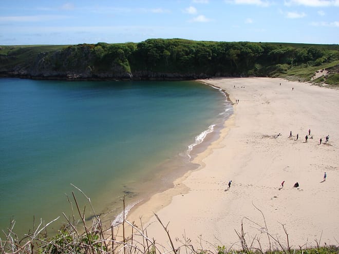
Photo: Sarah and Iain, CC BY 2.0, via Wikimedia Commons