






Eildon and Leaderfoot by Train
Photo: Jenny Gumbrell, CC BY-SA 2.0, via Geograph
Eildon and Leaderfoot is a Scottish Borders landscape of three volcanic hills, the wooded River Tweed and rolling farmland, with Eildon Mid Hill and Eildon Hill North giving sweeping views. Tweedbank and Galashiels stations on the Borders Railway put the hill walks within reach by train.
There is 1 station within a mile of Eildon and Leaderfoot National Scenic Area.
The area is home to 9 DoBIH-listed peaks, the highest being Eildon Mid Hill at 422m.
Eildon and Leaderfoot train stations
Best for walkers first: gold, silver and bronze rate the hills, landscape and trails near each.
Walking distances are estimates from the straight-line distance and the type of ground, not a measured route. Check a map before you set off.
Journey times from cities
How soon you can be at the nearest station serving the Eildon and Leaderfoot National Scenic Area from each city, counting stations just outside the boundary as well as inside it.
- Edinburgh to TweedbankFrom 1hr 1min
- Glasgow to TweedbankFrom 1hr 58min
- Stirling to TweedbankFrom 2hr 5min
- Dundee to TweedbankFrom 2hr 21min
- Newcastle to TweedbankFrom 2hr 35min
- Durham to TweedbankFrom 2hr 54min
- Lancaster to TweedbankFrom 3hr 26min
- Aberdeen to TweedbankFrom 3hr 38min
- York to TweedbankFrom 3hr 41min
- Preston to TweedbankFrom 3hr 42min
- Leeds to TweedbankFrom 4hr 6min
- Manchester to TweedbankFrom 4hr 24min
- Liverpool to TweedbankFrom 4hr 34min
- Inverness to TweedbankFrom 4hr 52min
- Sheffield to TweedbankFrom 4hr 52min
- Nottingham to TweedbankFrom 5hr 32min
- Birmingham to TweedbankFrom 5hr 37min
- London to TweedbankFrom 5hr 43min
- Leicester to TweedbankFrom 6hr 4min
- Cambridge to TweedbankFrom 6hr 9min
- Norwich to TweedbankFrom 6hr 51min
- Oxford to TweedbankFrom 7hr 5min
Good to know
Can you get to the Eildon and Leaderfoot National Scenic Area by train?
Yes. Tweedbank is within 1 mile of the Eildon and Leaderfoot National Scenic Area.
What is the nearest train station to the Eildon and Leaderfoot National Scenic Area?
Tweedbank, 0.3 miles away (about 0.3 to 0.4 miles on foot) from the Eildon and Leaderfoot National Scenic Area.
How long does it take to get to the Eildon and Leaderfoot National Scenic Area by train?
The Eildon and Leaderfoot National Scenic Area is 1hr 1min from Edinburgh, 1hr 58min from Glasgow, 2hr 5min from Stirling and 5hr 43min from London by train, to the nearest station.
More of Eildon and Leaderfoot
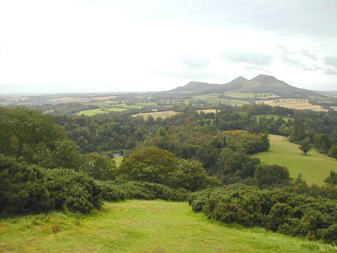
Photo: Wikimedia Commons contributor, CC BY-SA 3.0, via Wikimedia Commons