





Corpach Rail Station
- Canal
- Wild Land Area
- Peaks nearby
- 30
- highest 974m
- Walking routes
- 16
- within 10 miles
What's on the doorstep
Walking distances are estimates from the straight-line distance and the type of ground, not a measured route. Check a map before you set off.
About Corpach Rail Station
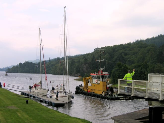
Corpach is a large village north of Fort William, in the Scottish Highlands. The canal lock at Corpach Basin on Loch Linnhe, east of the narrows leading to Loch Eil, is the western sea entrance of the Caledonian Canal. It is a natural harbour, unlike Fort William.
Source: Wikipedia, CC BY-SA.
Hills, trails and walks from the platform
Walking distances are estimates from the straight-line distance and the type of ground, not a measured route. Check a map before you set off.
| Meall Bhanbhaidh [Meall Bhanabhie] | 327m | 1.8 mi (about 2.5 mi on foot) |
| Meall an t-SlamainM | 467m | 2.4 mi (about 3 to 3.5 mi on foot) |
| Cow Hill | 298m | 2.5 mi (about 3.5 mi on foot) |
| Druim na h-EarbaM | 288m | 3.4 mi (about 4.5 to 5 mi on foot) |
| Meall an t-Suidhe | 711m | 3.5 mi (about 5 to 5.5 mi on foot) |
No National Trails within 10 miles.
Route data © OpenStreetMap contributors, ODbL – coverage and route quality vary by area.
| Cape Wrath Trail (Fort William → Invergarry → Morvich) ↗National | 66.3 mi | 0.1 mi |
| Great Glen Way ↗National | 76.9 mi | 0.1 mi |
| Crofters Woods Walk ↗Local | 1.4 mi | 0.7 mi |
| Cape Wrath Trail (Fort William → Glenfinnan → Morvich) ↗National | 71.2 mi | 1.0 mi |
| West Highland Way (Kinlochleven to Fort William) ↗National | 15.3 mi | 1.7 mi |