





Forsinard Rail Station
- National Nature Reserve
- Special Area of Conservation
- Wild Land Area
- Peaks nearby
- 30
- highest 590m
- Walking routes
- 0
- within 10 miles
What's on the doorstep
Causeymire -Knockfin FlowsWild Land Area · 1.8 mi (about 2 to 2.5 mi on foot)Also nearby
- Forsinard Flows
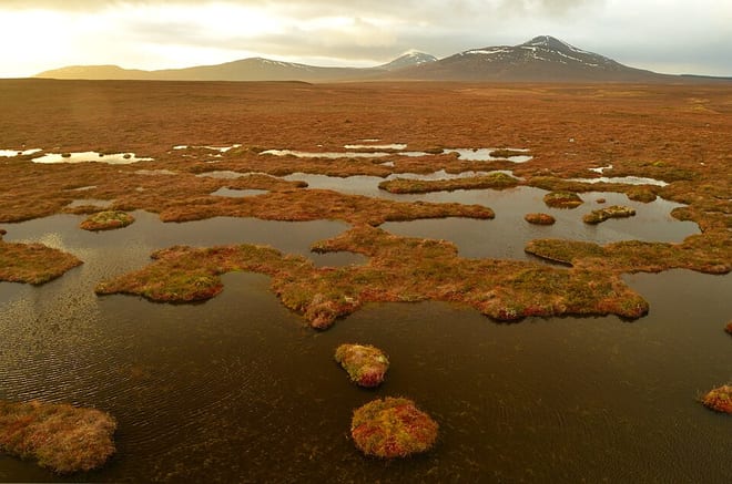
National Nature Reserve
Walking distances are estimates from the straight-line distance and the type of ground, not a measured route. Check a map before you set off.
About Forsinard Rail Station
Forsinard is a hamlet in the county of Sutherland in the Highland area of Scotland. It is located on the A897 road in Strath Halladale. It is served by a railway station on the Far North Line. The local hotel closed several years ago, but there is now a B&B just across the level crossing.
Hills, trails and walks from the platform
Walking distances are estimates from the straight-line distance and the type of ground, not a measured route. Check a map before you set off.
| Meall a' Bhealaich | 338m | 1.4 mi (about 2 mi on foot) |
| Sletill Hill | 280m | 3.4 mi (about 4.5 to 5 mi on foot) |
| Ben Griam BegM | 580m | 3.8 mi (about 5 to 5.5 mi on foot) |
| Creag Sail a' Bhathaich | 349m | 3.9 mi (about 5 to 5.5 mi on foot) |
| Meall a' Bhuirich | 407m | 4.0 mi (about 5 to 6 mi on foot) |
No National Trails within 10 miles.
Route data © OpenStreetMap contributors, ODbL – coverage and route quality vary by area.
No waymarked routes within 10 miles.