





Morar Rail Station
- Lake or reservoir
- Special Area of Conservation
- Peaks nearby
- 30
- highest 95m
- Walking routes
- 1
- within 10 miles
What's on the doorstep
Walking distances are estimates from the straight-line distance and the type of ground, not a measured route. Check a map before you set off.
About Morar Rail Station
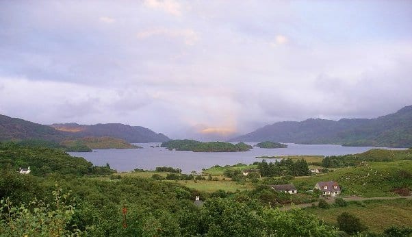
Morar is a small village on the west coast of The Rough Bounds of Scotland, three miles south of Mallaig. The name Morar is also applied to the northern part of the peninsula containing the village, though North Morar is more usual. The coastline of the area forms part of the Morar, Moidart and Ardnamurchan National Scenic Area, one of 40 such areas in Scotland, which are defined so as to identify areas of exceptional scenery and to ensure its protection by restricting certain forms of development.
Hills, trails and walks from the platform
Walking distances are estimates from the straight-line distance and the type of ground, not a measured route. Check a map before you set off.
| Morar Hill | 84m | 0.2 mi (about 0.3 mi on foot) |
| Druim Seangain | 71m | 0.7 mi (about 0.9 to 1 mi on foot) |
| Kinsadel Hill | 61m | 0.7 mi (about 1 mi on foot) |
| Beoraidbeg Hill | 124m | 0.7 mi (about 1 mi on foot) |
| Bourblach Hill | 118m | 0.9 mi (about 1 to 1.5 mi on foot) |
No National Trails within 10 miles.
Route data © OpenStreetMap contributors, ODbL – coverage and route quality vary by area.