






Ardlui Rail Station
- National Park
- National Scenic Area
- Lake or reservoir
- Scotland's Great Trail
- Wild Land Area
- Peaks nearby
- 30
- highest 943m
- Walking routes
- 16
- within 10 miles
What's on the doorstep
Loch Lomond and The Trossachs National ParkNational Park Loch LomondNational Scenic Area
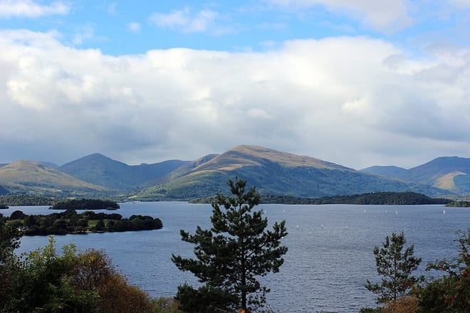 Loch LomondLake or reservoir
 West Highland WayScotland's Great Trail · 0.6 mi (about 0.8 to 0.9 mi on foot)
 Ben More - Ben LediWild Land Area · 0.7 mi (about 0.8 to 1 mi on foot)
 Ben LuiWild Land Area · 1.6 mi (about 2 mi on foot)
Walking distances are estimates from the straight-line distance and the type of ground, not a measured route. Check a map before you set off.
About Ardlui Rail Station
Ardlui is a hamlet in Argyll and Bute, Scottish Highlands. It is located at the head of Loch Lomond. It is on the A82 road between Crianlarich and Glasgow and Ardlui railway station is on the West Highland Line between Glasgow Queen Street and Oban or Fort William.
Source: Wikipedia, CC BY-SA.
Hills, trails and walks from the platform
Walking distances are estimates from the straight-line distance and the type of ground, not a measured route. Check a map before you set off.
| Cnap Mor | 164m | 0.6 mi (about 0.8 to 0.9 mi on foot) |
| Stob an Fhithich | 419m | 0.8 mi (about 1 mi on foot) |
| Stob nan Coinnich Bhacain | 647m | 1.0 mi (about 1.5 mi on foot) |
| Cruach | 514m | 1.4 mi (about 2 mi on foot) |
| Beinn Ducteach West Top | 499m | 1.6 mi (about 2 mi on foot) |
No National Trails within 10 miles.
Route data © OpenStreetMap contributors, ODbL – coverage and route quality vary by area.
| West Highland Way (Rowardennan to Inverarnan) ↗National | 13.7 mi | 0.6 mi |
| West Highland Way (Inverarnan to Tyndrum) ↗National | 12.1 mi | 2.0 mi |
| Upland Trail ↗Local | 1.2 mi | 3.0 mi |
| Mary Queen of Scots Way ↗Regional | 25.8 mi | 3.5 mi |
| Loch Lomond and Cowal Way ↗National | 56.5 mi | 3.5 mi |