





Attadale Rail Station
- Wild Land Area
- River
- Peaks nearby
- 30
- highest 730m
- Walking routes
- 9
- within 10 miles
What's on the doorstep
Central HighlandsWild Land Area · 1.2 mi (about 1.5 mi on foot)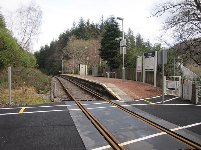 Coulin & Ledgowan ForestWild Land Area · 2.4 mi (about 3 mi on foot)
Also nearby
Walking distances are estimates from the straight-line distance and the type of ground, not a measured route. Check a map before you set off.
Hills, trails and walks from the platform
Walking distances are estimates from the straight-line distance and the type of ground, not a measured route. Check a map before you set off.
| Carn Ruairidh | 378m | 1.5 mi (about 2 mi on foot) |
| Carn nan Iomairean North Top | 435m | 1.7 mi (about 2.5 mi on foot) |
| Creag Dhubh Beag | 313m | 2.2 mi (about 3 mi on foot) |
| Carn nan IomaireanM | 485m | 2.5 mi (about 3.5 mi on foot) |
| Cnoc Lochcarron | 212m | 2.6 mi (about 3.5 mi on foot) |
No National Trails within 10 miles.
Route data © OpenStreetMap contributors, ODbL – coverage and route quality vary by area.
| Cape Wrath Trail (Bendronaig → Strathcarron → Kinlochewe) ↗National | 23.8 mi | 1.9 mi |
| Cape Wrath Trail (Glomach-Killian-Bendronaig) ↗National | 13.5 mi | 2.6 mi |
| Strome Woodland Trail ↗ | 0.9 mi | 4.8 mi |
| Cape Wrath Trail (Bendronaig → Craig → Kinlochewe) ↗National | 20.7 mi | 5.8 mi |
| Cape Wrath Trail (Morvich → Bendronaig) ↗National | 18.9 mi | 5.8 mi |