





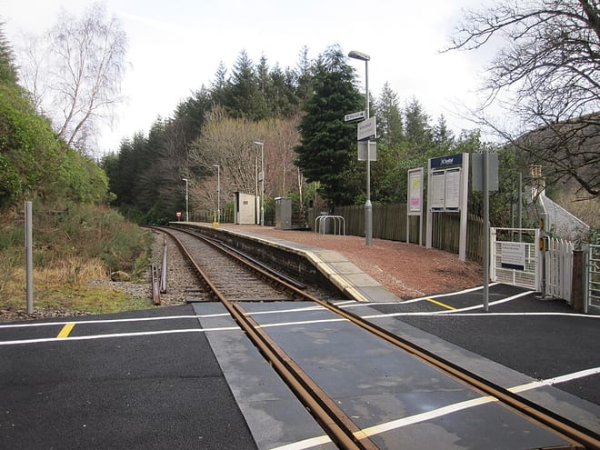
Coulin & Ledgowan Forest by Train
Photo: Glen Wallace from Inverness, Scotland, CC BY-SA 2.0, via Wikimedia Commons
Coulin and Ledgowan Forest is a Wester Ross landscape of sandstone Munros, pine woods, lochs and remote glens, with Sgorr Ruadh, Maol Chean-dearg and Fuar Tholl rising above Glen Carron and Loch Coulin. Achnashellach and Strathcarron stations on the Kyle Line give train access to the hills.
There are 3 stations within 3 miles of the Coulin & Ledgowan Forest Wild Land Area.
The area is home to 115 DoBIH-listed peaks, the highest being Liathach - Spidean a' Choire Leith at 1055m.
Coulin & Ledgowan Forest train stations
Best for walkers first: gold, silver and bronze rate the hills, landscape and trails near each.
- Achnashellach0.4 mi (about 0.5 to 0.6 mi on foot) · closestGold walking rating
- Strathcarron1.5 mi (about 2 mi on foot)Gold walking rating
- Attadale2.4 mi (about 3 mi on foot)Gold walking rating
Walking distances are estimates from the straight-line distance and the type of ground, not a measured route. Check a map before you set off.
Journey times from cities
How soon you can be at the nearest station serving the Coulin & Ledgowan Forest Wild Land Area from each city, counting stations just outside the boundary as well as inside it.
- Inverness to AchnashellachFrom 1hr 47min
- Aberdeen to AchnashellachFrom 4hr 21min
- Stirling to AchnashellachFrom 5hr 10min
- Dundee to AchnashellachFrom 5hr 25min
- Glasgow to AchnashellachFrom 5hr 25min
- Edinburgh to AchnashellachFrom 5hr 50min
- Newcastle to AchnashellachFrom 7hr 45min
- Durham to AchnashellachFrom 7hr 59min
- Lancaster to AchnashellachFrom 8hr 6min
- Preston to AchnashellachFrom 8hr 22min
- York to AchnashellachFrom 8hr 51min
- Manchester to AchnashellachFrom 9hr 4min
- Leeds to AchnashellachFrom 9hr 43min
- Sheffield to AchnashellachFrom 9hr 52min
- Liverpool to AchnashellachFrom 9hr 59min
- Birmingham to AchnashellachFrom 10hr 37min
- London to AchnashellachFrom 10hr 44min
- Nottingham to AchnashellachFrom 10hr 58min
- Leicester to AchnashellachFrom 11hr 5min
- Cambridge to AchnashellachFrom 11hr 9min
- Norwich to AchnashellachFrom 11hr 49min
- Oxford to AchnashellachFrom 12hr 5min
Good to know
Can you get to the Coulin & Ledgowan Forest Wild Land Area by train?
Yes. 3 stations are within 3 miles of the Coulin & Ledgowan Forest Wild Land Area, including Achnashellach and Strathcarron.
What is the nearest train station to the Coulin & Ledgowan Forest Wild Land Area?
Achnashellach, 0.4 miles away (about 0.5 to 0.6 miles on foot) from the Coulin & Ledgowan Forest Wild Land Area.
How long does it take to get to the Coulin & Ledgowan Forest Wild Land Area by train?
The Coulin & Ledgowan Forest Wild Land Area is 1hr 47min from Inverness, 4hr 21min from Aberdeen, 5hr 10min from Stirling and 10hr 44min from London by train, to the nearest station.