





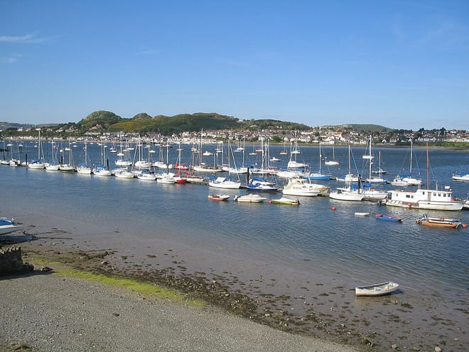
Deganwy Rail Station
- River
- Special Area of Conservation
- National Park
- Heritage Coast
- Peaks nearby
- 30
- highest 93m
- Walking routes
- 13
- within 10 miles
What's on the doorstep
Afon ConwyRiver · 0.1 mi (about 0.2 mi on foot) Eryri / SnowdoniaNational Park · 0.8 mi (about 1 mi on foot)
 Great OrmeHeritage Coast · 1.9 mi (about 2.5 to 3 mi on foot)
Also nearby
- Y Fenai a Bae Conwy/ Menai Strait and Conwy Bay
Special Area of Conservation
0.2 mi (about 0.2 mi on foot)
Walking distances are estimates from the straight-line distance and the type of ground, not a measured route. Check a map before you set off.
About Deganwy Rail Station
Deganwy is a town and electoral ward in the community of Conwy in Conwy County Borough in Wales. It lies in the Creuddyn Peninsula alongside Llandudno and Rhos-on-Sea. Historically part of Caernarfonshire, the peninsula is in a region of north Wales where as many as 1 in 3 residents can speak Welsh, and is home to some of the most expensive streets in Wales. Deganwy is located on the east bank of the River Conwy. The original wooden castle was rebuilt in stone after 1210. Deganwy is in the ecclesiastical parish of Llanrhos, and has a Victorian era Gothic parish church dedicated to All Saints.
Hills, trails and walks from the platform
Walking distances are estimates from the straight-line distance and the type of ground, not a measured route. Check a map before you set off.
| Degannwy Castle | 110m | 0.3 mi (about 0.3 to 0.4 mi on foot) |
| Bodlondeb Wood | 57m | 0.6 mi (about 0.8 to 0.9 mi on foot) |
| Bryniau | 93m | 1.1 mi (about 1.5 mi on foot) |
| Bryn Maelgwyn | 105m | 1.4 mi (about 2 mi on foot) |
| Mynydd y Dref [Conwy Mountain] | 244m | 1.4 mi (about 2 mi on foot) |
No National Trails within 10 miles.
Route data © OpenStreetMap contributors, ODbL – coverage and route quality vary by area.
| Wales Coast Path (North Wales) main route ↗National | 86.1 mi | 0.0 mi |
| North Wales Path ↗Regional | 59.9 mi | 0.0 mi |
| Conwy Mountain alternative ↗National | 10.0 mi | 0.5 mi |
| Cambrian Way ↗National | 300.1 mi | 0.8 mi |
| Jubilee Path ↗Local | 1.4 mi | 3.1 mi |