





Glan Conwy Rail Station
- River
- National Park
- Heritage Coast
- Peaks nearby
- 30
- highest 93m
- Walking routes
- 15
- within 10 miles
What's on the doorstep
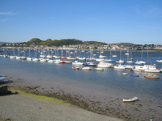
Afon ConwyRiver · 0.4 mi (about 0.5 to 0.6 mi on foot) Eryri / SnowdoniaNational Park · 2.0 mi (about 2.5 mi on foot)
 Great OrmeHeritage Coast · 4.3 mi (about 5.5 to 6.5 mi on foot)
Walking distances are estimates from the straight-line distance and the type of ground, not a measured route. Check a map before you set off.
About Glan Conwy Rail Station
Llansanffraid Glan Conwy, usually shortened to Glan Conwy, is a village, community and electoral ward in Conwy County Borough, Wales. The name translates from the Welsh as Church of St Ffraid on the bank of the River Conwy. The village was founded in the 5th century and in the past had a marine-based economy, but it is now largely residential. The population was 2,290 in 2001, reducing to 2,196 at the 2011 census. It includes the village of Pentrefelin.
Hills, trails and walks from the platform
Walking distances are estimates from the straight-line distance and the type of ground, not a measured route. Check a map before you set off.
| Coed Dolwyd | 134m | 0.9 mi (about 1 to 1.5 mi on foot) |
| Bryniau | 91m | 0.9 mi (about 1 to 1.5 mi on foot) |
| Iolyn Park | 129m | 1.3 mi (about 1.5 to 2 mi on foot) |
| Ffridd y Mynydd North Top | 257m | 1.5 mi (about 2 mi on foot) |
| Iolyn Park (old GR) | 129m | 1.5 mi (about 2 mi on foot) |
No National Trails within 10 miles.
Route data © OpenStreetMap contributors, ODbL – coverage and route quality vary by area.
| North Wales Path ↗Regional | 59.9 mi | 1.4 mi |
| Wales Coast Path (North Wales) main route ↗National | 86.1 mi | 1.4 mi |
| Cambrian Way ↗National | 300.1 mi | 1.5 mi |
| Conwy Mountain alternative ↗National | 10.0 mi | 2.0 mi |
| Bodnant's Winter Garden Trail ↗Local | 0.2 mi | 2.3 mi |