






Helensburgh Upper Rail Station
- Scotland's Great Trail
- National Park
- Lake or reservoir
- Peaks nearby
- 30
- highest 97m
- Walking routes
- 20
- within 10 miles
What's on the doorstep
John Muir WayScotland's Great Trail Loch Lomond and The Trossachs National ParkNational Park · 1.0 mi (about 1 to 1.5 mi on foot)
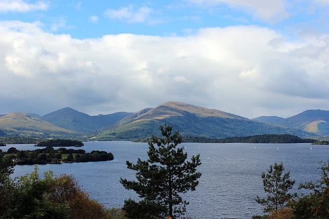 Loch LomondLake or reservoir · 4.0 mi (about 5 to 5.5 mi on foot)
Walking distances are estimates from the straight-line distance and the type of ground, not a measured route. Check a map before you set off.
About Helensburgh Upper Rail Station
Helensburgh Upper railway station serves the town of Helensburgh, Scotland, on the north shore of the Firth of Clyde to the west of Glasgow. It is located in a residential area uphill from the town centre and is by far the smaller of the town's two stations. It is on the West Highland Line, 2 miles 8 chains (3.4 km) from Craigendoran Junction, near Helensburgh, the first station on the line before Garelochhead. ScotRail manage the station and operate most services, with others provided by Caledonian Sleeper.
Hills, trails and walks from the platform
Walking distances are estimates from the straight-line distance and the type of ground, not a measured route. Check a map before you set off.
| Ben BowieM | 313m | 2.5 mi (about 3.5 mi on foot) |
| Killoeter | 300m | 2.8 mi (about 3.5 to 4 mi on foot) |
| The FruinM | 361m | 2.8 mi (about 3.5 to 4 mi on foot) |
| Gallow Hill | 128m | 2.9 mi (about 4 to 4.5 mi on foot) |
| Clach MacKenny | 202m | 3.7 mi (about 5 to 5.5 mi on foot) |
No National Trails within 10 miles.
Route data © OpenStreetMap contributors, ODbL – coverage and route quality vary by area.