





Ilkley Rail Station
- River
- National Nature Reserve
- Special Area of Conservation
- National Landscape
- National Park
- Peaks nearby
- 27
- highest 485m
- Walking routes
- 21
- within 10 miles
What's on the doorstep
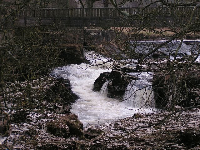
River WharfeRiver · 0.2 mi (about 0.3 mi on foot) Nidderdale National LandscapeNational Landscape · 0.9 mi (about 1 to 1.5 mi on foot)
 Yorkshire DalesNational Park · 2.8 mi (about 3.5 to 4 mi on foot)
Also nearby
Walking distances are estimates from the straight-line distance and the type of ground, not a measured route. Check a map before you set off.
About Ilkley Rail Station
Ilkley is a spa town and civil parish in the City of Bradford in West Yorkshire, in Northern England. Historically part of the West Riding of Yorkshire, Ilkley civil parish includes the adjacent village of Ben Rhydding and is part of the Ilkley and Addingham ward within the City of Bradford. Approximately 12 miles (19 km) north of Bradford and 17 miles (27 km) north-west of Leeds, the town lies mainly on the south bank of the River Wharfe in Wharfedale, one of the Yorkshire Dales.
Hills, trails and walks from the platform
Walking distances are estimates from the straight-line distance and the type of ground, not a measured route. Check a map before you set off.
| Rombalds Moor [Ilkley Moor]M | 403m | 1.5 mi (about 2 mi on foot) |
| Burley Moor | 342m | 2.4 mi (about 3 to 3.5 mi on foot) |
| The Old Pike | 400m | 3.3 mi (about 4 to 4.5 mi on foot) |
| Crier Hill | 166m | 3.7 mi (about 5 to 5.5 mi on foot) |
| Round Hill | 409m | 3.7 mi (about 5 to 5.5 mi on foot) |
| Pennine Way ↗ | 270.6 mi | 9.8 mi |
Route data © OpenStreetMap contributors, ODbL – coverage and route quality vary by area.
| Ebor Way ↗Regional | 76.3 mi | 0.0 mi |
| Dales Way Link ↗Regional | 20.9 mi | 0.1 mi |
| Dales Way - Harrogate Link Path ↗Local | 16.2 mi | 0.2 mi |
| Dales Way Link ↗Regional | 11.8 mi | 0.3 mi |
| Dales Way ↗Regional | 80.5 mi | 0.4 mi |