






Kings Sutton Rail Station
- River
- Canal
- Peaks nearby
- 10
- highest 228m
- Walking routes
- 20
- within 10 miles
What's on the doorstep
River CherwellRiver · 0.1 mi (about 0.1 mi on foot)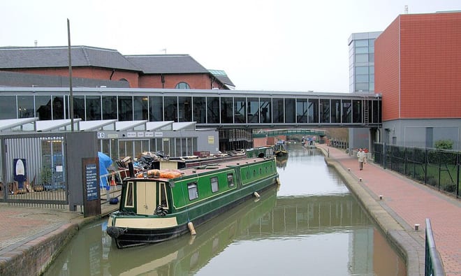 Oxford CanalCanal · 0.2 mi (about 0.2 to 0.3 mi on foot)
Walking distances are estimates from the straight-line distance and the type of ground, not a measured route. Check a map before you set off.
About Kings Sutton Rail Station
King's Sutton is a village and civil parish in West Northamptonshire, Northamptonshire, England, in the valley of the River Cherwell. It is sited about 4.1 miles (6.6 km) south-east of Banbury, Oxfordshire. The parish includes the hamlets of Astrop, contiguous with eastern end of King's Sutton, and Upper Astrop, about 1 mile (1.6 km) north-east, in the same area as the shrunken villages of Great and Little Purston.
Hills, trails and walks from the platform
Walking distances are estimates from the straight-line distance and the type of ground, not a measured route. Check a map before you set off.
| Crouch Hill | 170m | 3.9 mi (about 5 to 5.5 mi on foot) |
| Steepness Hill | 154m | 4.5 mi (about 6 to 6.5 mi on foot) |
| Thenford Hill | 187m | 5.4 mi (about 7 to 8 mi on foot) |
| Upper Wardington Hill | 179m | 6.4 mi (about 8.5 to 9 mi on foot) |
| Barton Hill | 197m | 7.5 mi (about 9.5 to 11 mi on foot) |
No National Trails within 10 miles.
Route data © OpenStreetMap contributors, ODbL – coverage and route quality vary by area.
| Oxford Canal Walk ↗Regional | 82.3 mi | 0.2 mi |
| Adderbury Circular Walk ↗Local | 3.2 mi | 1.3 mi |
| Deddington Circular Walk - East ↗Local | 6.2 mi | 1.9 mi |
| Jurassic Way ↗Regional | 89.3 mi | 2.0 mi |
| Grimsbury 5km ↗Local | 2.9 mi | 3.2 mi |