





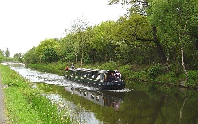
Gilshochill Rail Station
- Canal
- Scotland's Great Trail
- Peaks nearby
- 30
- highest 83m
- Walking routes
- 20
- within 10 miles
What's on the doorstep
Forth and Clyde CanalCanal · 0.3 mi (about 0.3 to 0.4 mi on foot) Forth and Clyde and Union Canal TowpathScotland's Great Trail · 0.3 mi (about 0.3 to 0.4 mi on foot)
Walking distances are estimates from the straight-line distance and the type of ground, not a measured route. Check a map before you set off.
About Gilshochill Rail Station
Gilshochill is located to the north west of Maryhill in the city of Glasgow, Scotland. Immediately north of Maryhill basin and Maryhill locks, it is the district where the Bowling and Port Dundas branches of the Forth and Clyde Canal meet at Stockingfield Junction. Situated on a hill overlooking Glasgow, its highest point sits at an elevation of about 150 metres above sea level. Gilshochill is spread over the area around Sandbank Street, bordering the areas of Cadder and Summerston. It falls under the G20 area postal code. It is served by Gilshochill railway station. A new footbridge connecting the area with Ruchill and providing a better link to Maryhill was installed across the canal at Stockingfield Junction in 2022.
Hills, trails and walks from the platform
Walking distances are estimates from the straight-line distance and the type of ground, not a measured route. Check a map before you set off.
| Ruchill | 83m | 0.9 mi (about 1 to 1.5 mi on foot) |
| Crow Hill | 82m | 2.0 mi (about 2.5 to 3 mi on foot) |
| Cairn Hill | 73m | 2.1 mi (about 2.5 to 3 mi on foot) |
| Douglas Park | 81m | 2.1 mi (about 3 mi on foot) |
| Springburn Park | 111m | 2.4 mi (about 3 to 3.5 mi on foot) |
No National Trails within 10 miles.
Route data © OpenStreetMap contributors, ODbL – coverage and route quality vary by area.
| Forth & Clyde/Union Canal Towpath ↗National | 63.1 mi | 0.3 mi |
| Kelvin Walkway ↗Local | 7.5 mi | 0.7 mi |
| Cairnhill Woods ↗Local | 0.5 mi | 1.8 mi |
| Thomas Muir Trail ↗Local | 11.7 mi | 2.0 mi |
| Allander Walkway ↗Local | 2.8 mi | 2.1 mi |