





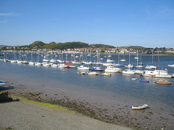
Llanrwst Rail Station
- River
- National Park
- Special Area of Conservation
- Lake or reservoir
- Peaks nearby
- 30
- highest 676m
- Walking routes
- 20
- within 10 miles
What's on the doorstep
Afon ConwyRiver · 0.2 mi (about 0.2 mi on foot) Eryri / SnowdoniaNational Park · 0.5 mi (about 0.6 to 0.7 mi on foot)
Also nearby
- Mwyngloddiau Fforest Gwydir/ Gwydyr Forest Mines
Special Area of Conservation
0.6 mi (about 0.7 to 0.8 mi on foot)
Walking distances are estimates from the straight-line distance and the type of ground, not a measured route. Check a map before you set off.
About Llanrwst Rail Station
Llanrwst is a market town and community in Conwy County Borough, Wales. It is on the east bank of the River Conwy and the A470 road, and lies within the historic county boundaries of Denbighshire. It developed around the wool trade and became known also for the making of harps and clocks. Today, less than one mile from the edge of Snowdonia, its main industry is tourism. Notable buildings include almshouses, two 17th-century chapels, and the Parish Church of St Grwst, which holds the stone coffin of Llywelyn the Great. At the 2021 census, the community had a population of 3,128.
Hills, trails and walks from the platform
Walking distances are estimates from the straight-line distance and the type of ground, not a measured route. Check a map before you set off.
| Parc Uchaf Gwydyr | 277m | 1.3 mi (about 1.5 to 2 mi on foot) |
| Pen-y-garth | 200m | 1.6 mi (about 2 to 2.5 mi on foot) |
| Grinllwm | 287m | 1.6 mi (about 2 to 2.5 mi on foot) |
| Pen y Drum | 319m | 1.9 mi (about 2.5 to 3 mi on foot) |
| Mynydd Bwlchyrhaearn | 332m | 2.1 mi (about 2.5 to 3 mi on foot) |
No National Trails within 10 miles.
Route data © OpenStreetMap contributors, ODbL – coverage and route quality vary by area.
| Lady Mary's Walk ↗Local | 1.2 mi | 0.6 mi |
| Conwy Panorama Walk ↗Local | 3.7 mi | 0.6 mi |
| Hafna Miners' Trail ↗Local | 2.1 mi | 1.3 mi |
| Llwybr Llechi Eryri ↗Regional | 84.3 mi | 3.0 mi |
| Ty'n y Coed Uchaf and Cwm Eidda walk, Ysbyty ↗Local | 5.1 mi | 5.5 mi |