






Llandudno Rail Station
- Special Area of Conservation
- Heritage Coast
- National Nature Reserve
- River
- National Park
- Peaks nearby
- 30
- highest 93m
- Walking routes
- 12
- within 10 miles
What's on the doorstep
Great OrmeHeritage Coast · 0.6 mi (about 0.8 to 0.9 mi on foot)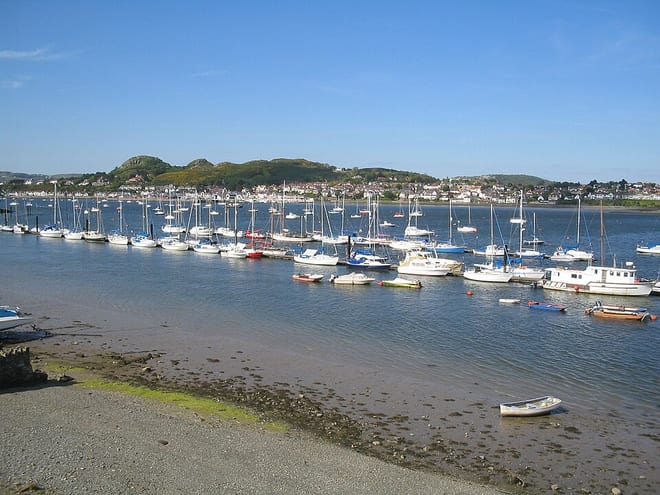 Afon ConwyRiver · 1.5 mi (about 2 mi on foot)
 Eryri / SnowdoniaNational Park · 2.6 mi (about 3 to 3.5 mi on foot)
Also nearby
- Y Fenai a Bae Conwy/ Menai Strait and Conwy Bay
Special Area of Conservation
0.4 mi (about 0.5 to 0.6 mi on foot)
Walking distances are estimates from the straight-line distance and the type of ground, not a measured route. Check a map before you set off.
About Llandudno Rail Station
Llandudno is a seaside resort, town and community in Conwy County Borough, Wales, located on the Creuddyn peninsula, which protrudes into the Irish Sea. In the 2021 UK census, the Llandudno community, which includes Gogarth, Penrhyn Bay, Craigside, Glanwydden, Penrhynside and Bryn Pydew had a population of around 19,700. The town takes its name from Saint Tudno, with Llandudno meaning "Church of Saint Tudno".
Hills, trails and walks from the platform
Walking distances are estimates from the straight-line distance and the type of ground, not a measured route. Check a map before you set off.
| Bryniau | 93m | 0.9 mi (about 1 to 1.5 mi on foot) |
| Bryn Maelgwyn | 105m | 1.2 mi (about 1.5 mi on foot) |
| Coed Gaer | 134m | 1.2 mi (about 1.5 mi on foot) |
| Great Orme [Y Gogarth]M | 207m | 1.3 mi (about 1.5 to 2 mi on foot) |
| Degannwy Castle | 110m | 1.6 mi (about 2 to 2.5 mi on foot) |
No National Trails within 10 miles.
Route data © OpenStreetMap contributors, ODbL – coverage and route quality vary by area.
| Wales Coast Path (North Wales) main route ↗National | 86.1 mi | 0.2 mi |
| North Wales Path ↗Regional | 59.9 mi | 0.2 mi |
| Conwy Mountain alternative ↗National | 10.0 mi | 2.4 mi |
| Cambrian Way ↗National | 300.1 mi | 2.7 mi |
| Woodland Trail ↗Local | 1.3 mi | 3.0 mi |