






Milford (Surrey) Rail Station
- National Nature Reserve
- Special Area of Conservation
- National Landscape
- River
- Disused railway
- Peaks nearby
- 28
- highest 92m
- Walking routes
- 21
- within 10 miles
What's on the doorstep
Surrey Hills National LandscapeNational Landscape · 0.8 mi (about 1 mi on foot)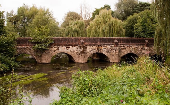 River WeyRiver · 1.4 mi (about 1.5 to 2 mi on foot)
Also nearby
Walking distances are estimates from the straight-line distance and the type of ground, not a measured route. Check a map before you set off.
About Milford (Surrey) Rail Station
Milford is a village in the civil parish of Witley and Milford south west of Godalming in Surrey, England. It was a small village in the early medieval period; it grew significantly after the building of the Portsmouth Direct Line which serves Godalming railway station and its own minor stop railway station. The village, served by a wide array of shops and amenities, has to one side an all-directions junction of the A3, one of Britain's trunk roads. Nearby settlements are Eashing, Shackleford, Witley and Elstead, and the hamlets of Enton and Hydestile, all of which are in the Borough of Waverley. The west of the parish is in the Surrey Hills AONB.
Hills, trails and walks from the platform
Walking distances are estimates from the straight-line distance and the type of ground, not a measured route. Check a map before you set off.
| Aaron's Hill | 86m | 1.7 mi (about 2 to 2.5 mi on foot) |
| Hydon's Ball | 181m | 1.8 mi (about 2.5 mi on foot) |
| Sandhills | 155m | 2.1 mi (about 2.5 to 3 mi on foot) |
| Breakneck Hill | 189m | 3.2 mi (about 4 to 4.5 mi on foot) |
| Yewtree Nob | 140m | 3.3 mi (about 4.5 to 5 mi on foot) |
| North Downs Way ↗ | 158.9 mi | 3.9 mi |
Route data © OpenStreetMap contributors, ODbL – coverage and route quality vary by area.
| Heathland Hike, Hindhead ↗Local | 3.7 mi | 0.9 mi |
| Nature Trail, Hindhead ↗Local | 0.9 mi | 1.4 mi |
| The Fox Way ↗Local | 37.5 mi | 1.5 mi |
| Octavia Hill Walk around Hydon's Ball and Heath, Hindhead ↗Local | 1.6 mi | 1.6 mi |
| Winkworth to Oakhurst Wonder Walk, Winkworth ↗Local | 3.7 mi | 1.7 mi |