






Walk the North Downs Way by Train
Photo: GkgAlf at English Wikipedia, CC BY-SA 3.0, via Wikimedia Commons
The North Downs Way follows chalk ridges through Surrey and Kent, passing beech woods, Box Hill viewpoints, orchards and hidden valleys on the way to the white cliffs of Dover. Farnham, Dorking, Box Hill and Westhumble, and Canterbury West stations give train access along the route.
There are 45 stations within 2.6 miles of the North Downs Way National Trail.
The route passes 41 DoBIH-listed peaks, the highest being Botley Hill at 270m.
The North Downs Way in brief
- Length
- 153 miles (246 km)
- Time to walk it
- About 12 days
The time is for the whole route; you can also walk it a section at a time.
Walk it in sections: station to station
Day walks along the North Downs Way, each from one station to another. Miles are along the trail.
| Section | From | To | Along the trail |
|---|---|---|---|
| 1 | Farnham | Gomshall (0.7 mi (about 0.9 to 1 mi on foot) off) | 18.8 mi |
| 2 | Gomshall (0.7 mi (about 0.9 to 1 mi on foot) off) | Merstham | 16.5 mi |
| 3 | Merstham | Dunton Green (0.5 mi (about 0.6 to 0.7 mi on foot) off) | 19.0 mi |
| 4 | Dunton Green (0.5 mi (about 0.6 to 0.7 mi on foot) off) | Rochester (1.6 mi (about 2 mi on foot) off) | 19.3 mi |
| 5 | Rochester (1.6 mi (about 2 mi on foot) off) | Lenham (0.8 mi (about 1 mi on foot) off) | 17.1 mi |
| 6 | Lenham (0.8 mi (about 1 mi on foot) off) | Wye | 11.6 mi |
| 7 | Wye | Folkestone West (0.9 mi (about 1 to 1.5 mi on foot) off) | 15.8 mi |
| 8 | Folkestone West (0.9 mi (about 1 to 1.5 mi on foot) off) | Snowdown (0.8 mi (about 1 mi on foot) off) | 19.5 mi |
| 9 | Snowdown (0.8 mi (about 1 mi on foot) off) | Chilham (0.5 mi (about 0.6 to 0.7 mi on foot) off) | 15.6 mi |
North Downs Way train stations
In the order the route reaches them.
- Farnham0.1 mi (about 0.1 mi on foot)
- Aldershot2.1 mi (about 2.5 to 3 mi on foot)
- Ash2.0 mi (about 2.5 mi on foot)
- Wanborough1.5 mi (about 2 mi on foot)
- Farncombe1.7 mi (about 2 to 2.5 mi on foot)
- Shalford (Surrey)0.8 mi (about 1 mi on foot)Bronze walking rating
- Chilworth0.7 mi (about 0.8 to 0.9 mi on foot)Bronze walking rating
- Gomshall0.7 mi (about 0.9 to 1 mi on foot)Bronze walking rating
- Box Hill & Westhumble0.2 mi (about 0.3 mi on foot)Bronze walking rating
- Betchworth0.2 mi (about 0.2 mi on foot)Bronze walking rating
- Tadworth2.3 mi (about 3 mi on foot)
- Reigate0.8 mi (about 1 mi on foot)Bronze walking rating
- Merstham0.1 mi (about 0.2 mi on foot)Bronze walking rating
- Caterham1.2 mi (about 1.5 mi on foot)
- Oxted0.9 mi (about 1 to 1.5 mi on foot)Bronze walking rating
- Knockholt2.4 mi (about 3 mi on foot)
- Dunton Green0.5 mi (about 0.6 to 0.7 mi on foot)Bronze walking rating
- OtfordBronze walking rating
- Kemsing1.2 mi (about 1.5 mi on foot)
- Borough Green & Wrotham1.3 mi (about 1.5 mi on foot)
- Sole Street2.3 mi (about 3 mi on foot)
- Halling0.9 mi (about 1 mi on foot)Bronze walking rating
- Cuxton0.4 mi (about 0.5 mi on foot)Bronze walking rating
- Rochester1.6 mi (about 2 mi on foot)
- Snodland1.6 mi (about 2 mi on foot)
- Aylesford1.9 mi (about 2.5 mi on foot)
- Maidstone East2.4 mi (about 3 mi on foot)
- Bearsted1.3 mi (about 1.5 to 2 mi on foot)
- Hollingbourne0.7 mi (about 0.8 to 0.9 mi on foot)Bronze walking rating
- Harrietsham0.6 mi (about 0.7 to 0.8 mi on foot)Bronze walking rating
- Lenham0.8 mi (about 1 mi on foot)Bronze walking rating
- Charing (Kent)0.6 mi (about 0.7 to 0.8 mi on foot)Bronze walking rating
- WyeBronze walking rating
- Sandling1.5 mi (about 2 mi on foot)
- Folkestone West0.9 mi (about 1 to 1.5 mi on foot)Bronze walking rating
- Dover Priory0.2 mi (about 0.3 mi on foot)Bronze walking rating
- Martin Mill1.6 mi (about 2 mi on foot)
- Kearsney1.7 mi (about 2 to 2.5 mi on foot)
- Shepherds Well0.3 mi (about 0.3 to 0.4 mi on foot)Bronze walking rating
- Snowdown0.8 mi (about 1 mi on foot)Bronze walking rating
- Bekesbourne0.3 mi (about 0.4 to 0.5 mi on foot)Bronze walking rating
- Sturry2.1 mi (about 2.5 to 3 mi on foot)
- Canterbury West0.1 mi (about 0.2 mi on foot)
- Chartham0.7 mi (about 0.8 to 0.9 mi on foot)Bronze walking rating
- Chilham0.5 mi (about 0.6 to 0.7 mi on foot)Bronze walking rating
Walking distances are estimates from the straight-line distance and the type of ground, not a measured route. Check a map before you set off.
Good to know
How long is the North Downs Way?
The North Downs Way is 153 miles (246 km) long.
How long does it take to walk the North Downs Way?
About 12 days for the whole route. You can also walk it a section at a time, from one station to the next.
Where does the North Downs Way start and finish?
It starts at Farnham and finishes at Dover.
More of North Downs Way
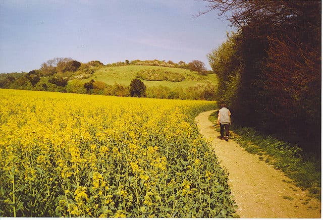
Photo: Colin Smith, CC BY-SA 2.0, via Geograph
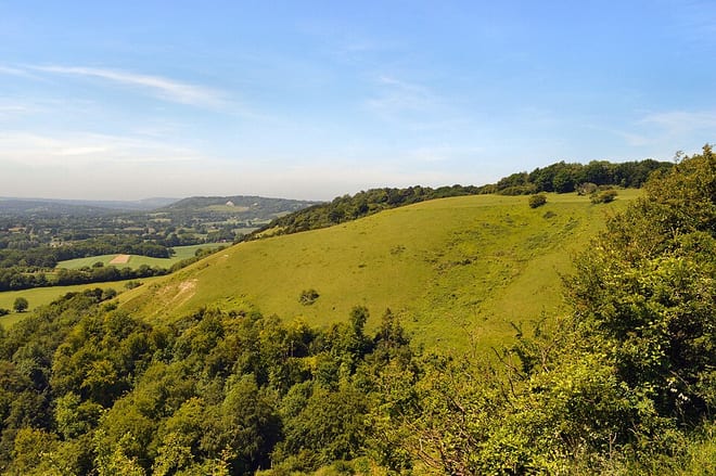
Photo: AndyScott, CC BY-SA 4.0, via Wikimedia Commons