





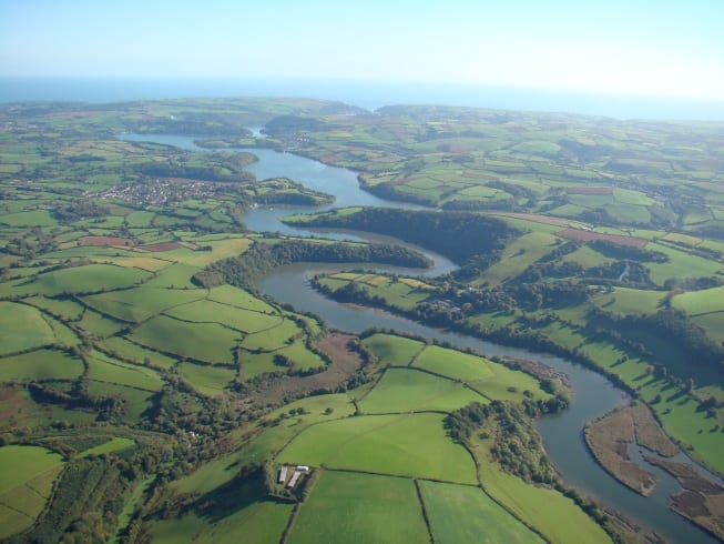
Totnes Rail Station
- River
- National Landscape
- National Park
- Peaks nearby
- 30
- highest 99m
- Walking routes
- 21
- within 10 miles
What's on the doorstep
River DartRiver · 0.2 mi (about 0.2 mi on foot) South Devon National LandscapeNational Landscape · 1.1 mi (about 1.5 mi on foot)
 DartmoorNational Park · 4.7 mi (about 5.5 to 6.5 mi on foot)
Walking distances are estimates from the straight-line distance and the type of ground, not a measured route. Check a map before you set off.
About Totnes Rail Station
Totnes is a market town and civil parish at the head of the estuary of the River Dart in Devon, England. It is about 5 miles (8 km) west of Paignton, about 7 miles (11 km) west-southwest of Torquay and about 20 miles (32 km) east-northeast of Plymouth, adjacent to the South Devon National Landscape. It is the administrative centre of the South Hams District Council. At the 2021 census, the parish had a population of 8,241.
Hills, trails and walks from the platform
Walking distances are estimates from the straight-line distance and the type of ground, not a measured route. Check a map before you set off.
| Dartington Hill | 86m | 1.3 mi (about 1.5 to 2 mi on foot) |
| Yarner Beacon | 81m | 1.6 mi (about 2 to 2.5 mi on foot) |
| Winton House Hill | 72m | 1.7 mi (about 2 to 2.5 mi on foot) |
| Fleet Hill | 103m | 1.7 mi (about 2 to 2.5 mi on foot) |
| Copperthorn Cross | 163m | 1.9 mi (about 2.5 to 3 mi on foot) |
| South West Coast Path ↗ | 663.3 mi | 5.7 mi |
Route data © OpenStreetMap contributors, ODbL – coverage and route quality vary by area.
| Franklin Totnes Trail ↗Local | 6.3 mi | 0.0 mi |
| Buckfastleigh to Totnes Trail ↗Regional | 7.5 mi | 0.2 mi |
| Dart Valley Trail ↗Regional | 16.3 mi | 0.4 mi |
| Torbay Totnes Trail (3T) ↗Local | 9.5 mi | 0.4 mi |
| John Musgrave Heritage Trail ↗Regional | 32.1 mi | 0.4 mi |