





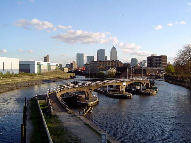
Hackney Wick Rail Station
- Canal
- Peaks nearby
- 24
- highest 92m
- Walking routes
- 21
- within 10 miles
What's on the doorstep
Walking distances are estimates from the straight-line distance and the type of ground, not a measured route. Check a map before you set off.
About Hackney Wick Rail Station
Hackney Wick is a neighbourhood in East London, England. The area forms the south-eastern part of the district of Hackney, and also of the wider London Borough of Hackney. Adjacent areas of the London Borough of Tower Hamlets, namely Fish Island, are sometimes also described as being part of Hackney Wick. The area lies 4.2 miles (6.8 km) northeast of Charing Cross.
Source: Wikipedia, CC BY-SA.
Hills, trails and walks from the platform
Walking distances are estimates from the straight-line distance and the type of ground, not a measured route. Check a map before you set off.
| Bethnal Green | 17m | 1.6 mi (about 2 to 2.5 mi on foot) |
| Wanstead Flats | 15m | 2.1 mi (about 3 mi on foot) |
| Swanfield Street | 18m | 2.4 mi (about 3 to 3.5 mi on foot) |
| Whitechapel | 15m | 2.6 mi (about 3.5 to 4 mi on foot) |
| Seven Sisters Road | 39m | 3.6 mi (about 4.5 to 5 mi on foot) |
| Thames Path ↗ | 213.5 mi | 2.4 mi |
Route data © OpenStreetMap contributors, ODbL – coverage and route quality vary by area.
| Capital Ring link to Hackney Wick station ↗Regional | 0.2 mi | 0.0 mi |
| Lea Valley Walk ↗Regional | 3.3 mi | 0.1 mi |
| Capital Ring (Section 13) ↗Regional | 3.8 mi | 0.1 mi |
| London to Walsingham - stage 01 ↗Local | 18.2 mi | 0.1 mi |
| Capital Ring (Section 14) ↗Regional | 4.0 mi | 0.2 mi |