





Harringay Rail Station
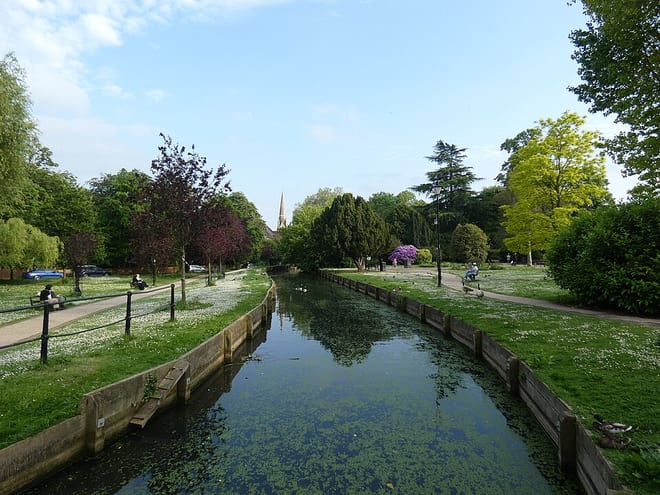
- Canal
- Peaks nearby
- 26
- highest 92m
- Walking routes
- 21
- within 10 miles
What's on the doorstep
Walking distances are estimates from the straight-line distance and the type of ground, not a measured route. Check a map before you set off.
About Harringay Rail Station
Harringay is a district of north London, England, within the London Borough of Haringey. It is centred on the section of Green Lanes running between the New River, where it crosses Green Lanes by Finsbury Park, and Duckett's Common, near Turnpike Lane.
Source: Wikipedia, CC BY-SA.
Hills, trails and walks from the platform
Walking distances are estimates from the straight-line distance and the type of ground, not a measured route. Check a map before you set off.
| Seven Sisters Road | 39m | 0.7 mi (about 1 mi on foot) |
| Highgate Hill | 100m | 1.7 mi (about 2 to 2.5 mi on foot) |
| Highgate | 129m | 2.0 mi (about 2.5 to 3 mi on foot) |
| Hampstead Lane | 116m | 2.8 mi (about 3.5 to 4 mi on foot) |
| Hampstead Heath | 136m | 3.4 mi (about 4.5 to 5 mi on foot) |
| Thames Path ↗ | 213.5 mi | 4.6 mi |
Route data © OpenStreetMap contributors, ODbL – coverage and route quality vary by area.
| New River Path ↗Regional | 28.8 mi | 0.0 mi |
| Harringay Passage ↗Local | 0.9 mi | 0.2 mi |
| Capital Ring (Section 12) ↗Regional | 5.5 mi | 0.4 mi |
| Parkland Walk (South) ↗Local | 1.7 mi | 0.4 mi |
| Capital Ring (section 12) - alternative ↗ | 0.5 mi | 0.5 mi |