






Kirkby Stephen Rail Station
- National Park
- Special Area of Conservation
- River
- National Trail
- National Landscape
- Peaks nearby
- 30
- highest 709m
- Walking routes
- 9
- within 10 miles
What's on the doorstep
Yorkshire DalesNational Park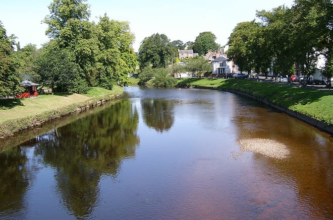 River Eden (Cumbria)River · 0.6 mi (about 0.7 to 0.8 mi on foot)
 Coast to CoastNational Trail · 0.6 mi (about 0.7 to 0.8 mi on foot)
 North Pennines National LandscapeNational Landscape · 0.8 mi (about 1 mi on foot)
Also nearby
Walking distances are estimates from the straight-line distance and the type of ground, not a measured route. Check a map before you set off.
About Kirkby Stephen Rail Station
Kirkby Stephen is a market town and civil parish in Westmorland and Furness, Cumbria, England. It lies on the A685 and is surrounded by sparsely populated hill country, about 25 miles (40 km) from the nearest larger towns, Kendal and Penrith. The River Eden rises 6 miles (10 km) away in the peat bogs below Hugh Seat and passes the eastern edge of the town. At the 2021 census, the parish had a population of 1,895.
Hills, trails and walks from the platform
Walking distances are estimates from the straight-line distance and the type of ground, not a measured route. Check a map before you set off.
| Ash Fell | 385m | 1.8 mi (about 2.5 mi on foot) |
| Birkett Hill | 383m | 1.9 mi (about 2.5 to 3 mi on foot) |
| Birkett Common | 352m | 2.0 mi (about 2.5 to 3 mi on foot) |
| High Out Wood | 352m | 2.1 mi (about 3 mi on foot) |
| Birkett Hill | 405m | 2.5 mi (about 3.5 mi on foot) |
| Coast to Coast ↗ | 202.4 mi | 0.6 mi |
| Pennine Bridleway ↗ | 206.0 mi | 3.3 mi |
| Pennine Way ↗ | 270.6 mi | 7.8 mi |
Route data © OpenStreetMap contributors, ODbL – coverage and route quality vary by area.
| Coast to Coast Walk (Shap to Richmond) ↗National | 59.3 mi | 0.6 mi |
| Lady Anne's Way ↗Regional | 96.6 mi | 0.8 mi |
| Dales High Way ↗Regional | 101.4 mi | 2.9 mi |
| Pennine Way (Hawes to Tan Hill) ↗National | 16.5 mi | 7.8 mi |
| Herriot Way ↗Regional | 49.5 mi | 7.8 mi |