





London Bridge Rail Station
- River
- Peaks nearby
- 29
- highest 92m
- Walking routes
- 21
- within 10 miles
What's on the doorstep
Walking distances are estimates from the straight-line distance and the type of ground, not a measured route. Check a map before you set off.
About London Bridge Rail Station
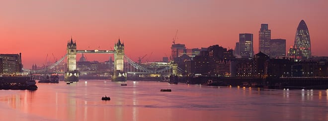
Since Roman times, several crossings named London Bridge have spanned the River Thames between the City of London and Southwark in central London. The current crossing, which opened to traffic in 1973, is a box girder bridge built from concrete and steel. It replaced a 19th-century stone-arched bridge, which in turn superseded a 600-year-old stone-built medieval structure. In addition to the roadway, for much of its history, the broad medieval bridge supported an extensive built up area of homes and businesses, part of the City's Bridge ward, and its southern end in Southwark was guarded by a large stone City gateway. The medieval bridge was preceded by a succession of timber bridges, the first of which was built by the Roman founders of London (Londinium) around AD 50.
Hills, trails and walks from the platform
Walking distances are estimates from the straight-line distance and the type of ground, not a measured route. Check a map before you set off.
| Whitechapel | 15m | 1.1 mi (about 1.5 mi on foot) |
| Chancery Lane/Holborn | 22m | 1.5 mi (about 2 mi on foot) |
| Swanfield Street | 18m | 1.5 mi (about 2 mi on foot) |
| Bethnal Green | 17m | 2.4 mi (about 3 to 3.5 mi on foot) |
| Forest Hill | 106m | 4.4 mi (about 5.5 to 6.5 mi on foot) |
| Thames Path ↗ | 213.5 mi | 0.1 mi |
Route data © OpenStreetMap contributors, ODbL – coverage and route quality vary by area.
| Thames Path ↗National | 194.7 mi | 0.1 mi |
| Jubilee Walkway (Eastern Loop) ↗Regional | 3.5 mi | 0.1 mi |
| Jubilee Greenway (section 8) ↗Regional | 2.4 mi | 0.1 mi |
| Southwark Cathedral to Otford ↗Regional | 23.1 mi | 0.2 mi |
| Thames Path - northern bank ↗Regional | 29.5 mi | 0.3 mi |