





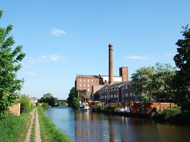
Bingley Rail Station
- Canal
- River
- National Nature Reserve
- Peaks nearby
- 30
- highest 459m
- Walking routes
- 22
- within 10 miles
What's on the doorstep
Walking distances are estimates from the straight-line distance and the type of ground, not a measured route. Check a map before you set off.
About Bingley Rail Station
Bingley is a market town and civil parish in the metropolitan borough of the City of Bradford, West Yorkshire, England. It is sited on the River Aire and the Leeds and Liverpool Canal. The town had a population of 18,040 at the 2021 Census.
Source: Wikipedia, CC BY-SA.
Hills, trails and walks from the platform
Walking distances are estimates from the straight-line distance and the type of ground, not a measured route. Check a map before you set off.
| Baildon Hill | 282m | 2.1 mi (about 3 mi on foot) |
| Chellow Heights | 262m | 2.6 mi (about 3.5 mi on foot) |
| Harrop Edge | 306m | 2.9 mi (about 3.5 to 4 mi on foot) |
| Lees Moor | 298m | 3.2 mi (about 4 to 4.5 mi on foot) |
| Idle Hill | 224m | 3.7 mi (about 5 to 5.5 mi on foot) |
| Pennine Way ↗ | 270.6 mi | 7.0 mi |
| Pennine Bridleway ↗ | 206.0 mi | 9.9 mi |
Route data © OpenStreetMap contributors, ODbL – coverage and route quality vary by area.
| Airedale Way ↗Regional | 47.7 mi | 0.2 mi |
| Welcome Way ↗Local | 22.6 mi | 0.2 mi |
| Bradford Millennium Way ↗Local | 47.3 mi | 0.5 mi |
| Millennium Way Circular Walk 16 ↗Local | 0.9 mi | 1.0 mi |
| Calder Aire Link ↗Local | 19.7 mi | 1.1 mi |