






Gargrave Rail Station
- National Trail
- River
- Canal
- National Park
- Disused railway
- Peaks nearby
- 30
- highest 508m
- Walking routes
- 22
- within 10 miles
What's on the doorstep
Pennine WayNational Trail · 0.2 mi (about 0.2 mi on foot) River AireRiver · 0.3 mi (about 0.4 mi on foot)
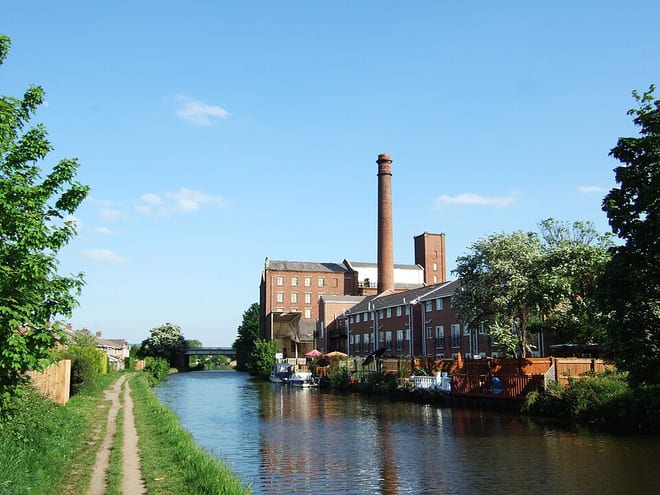 Leeds and Liverpool CanalCanal · 0.5 mi (about 0.6 to 0.7 mi on foot)
 Yorkshire DalesNational Park · 0.8 mi (about 1 mi on foot)
Also nearby
Walking distances are estimates from the straight-line distance and the type of ground, not a measured route. Check a map before you set off.
About Gargrave Rail Station
Gargrave is a large village and civil parish in the county of North Yorkshire, England. It is located along the A65, 4 miles (6 km) north-west of Skipton. The village is situated on the very edge of the Yorkshire Dales; the River Aire and the Leeds and Liverpool Canal pass through it. It had a population of 1,764 at the 2001 census, reducing slightly to 1,755 in 2011. Until 1974 it was part of the West Riding of Yorkshire and it was part of the Craven District from 1974 to 2023; it is now administered by the unitary North Yorkshire Council.
Hills, trails and walks from the platform
Walking distances are estimates from the straight-line distance and the type of ground, not a measured route. Check a map before you set off.
| Mickleber Hill | 178m | 0.4 mi (about 0.5 to 0.6 mi on foot) |
| Acliffe Hill | 180m | 1.2 mi (about 1.5 mi on foot) |
| Horrows Hill | 207m | 2.0 mi (about 2.5 to 3 mi on foot) |
| Sharp HawM | 357m | 2.0 mi (about 2.5 to 3 mi on foot) |
| Rough Haw | 339m | 2.4 mi (about 3 to 3.5 mi on foot) |
| Pennine Way ↗ | 270.6 mi | 0.2 mi |
| Pennine Bridleway ↗ | 206.0 mi | 5.1 mi |
Route data © OpenStreetMap contributors, ODbL – coverage and route quality vary by area.
| Pennine Way (Ickornshaw to Malham) ↗National | 17.5 mi | 0.2 mi |
| Airedale Way ↗Regional | 47.7 mi | 0.2 mi |
| Dales High Way ↗Regional | 101.4 mi | 2.0 mi |
| Lady Anne's Way ↗Regional | 96.6 mi | 3.4 mi |
| Pendle Way ↗Regional | 44.9 mi | 3.8 mi |