






Photo: Evilbish, CC BY 3.0, via Wikimedia Commons
The Peak District is a landscape of high heather moorland, gritstone edges and deep limestone dales, with Kinder Scout, Bleaklow and Grindslow Knoll overlooking river valleys and stepped ridgelines. Edale and Hope stations put classic Peak District walks within reach by train.
There are 37 stations within 3 miles of Peak District National Park.
The park area is home to 234 DoBIH-listed peaks, the highest being Kinder Scout at 636m.
National Trails pass through or near the park: Pennine Bridleway, Pennine Way.
Peak District train stations
Best for walkers first: gold, silver and bronze rate the hills, landscape and trails near each.
- EdaleGold walking rating
- Dove Holes0.4 mi (about 0.5 to 0.6 mi on foot)Gold walking rating
- Chapel-en-le-Frith0.5 mi (about 0.6 to 0.7 mi on foot)Gold walking rating
- Hadfield0.4 mi (about 0.5 to 0.6 mi on foot)Gold walking rating
- Buxton1.5 mi (about 1.5 to 2 mi on foot)Gold walking rating
- Dinting1.0 mi (about 1 to 1.5 mi on foot)Gold walking rating
- Chinley0.1 mi (about 0.1 mi on foot)Gold walking rating
- Whaley Bridge1.0 mi (about 1 to 1.5 mi on foot)Gold walking rating
- Hope (Derbyshire)Gold walking rating
- Furness Vale1.0 mi (about 1 to 1.5 mi on foot)Gold walking rating
- Glossop0.9 mi (about 1 mi on foot)Gold walking rating
- New Mills Newtown1.4 mi (about 1.5 to 2 mi on foot)Gold walking rating
- New Mills Central1.5 mi (about 2 mi on foot)Gold walking rating
- BamfordGold walking rating
- HathersageGold walking rating
- Broadbottom1.4 mi (about 1.5 to 2 mi on foot)Gold walking rating
- Strines1.6 mi (about 2 mi on foot)Gold walking rating
- Disley0.5 mi (about 0.6 to 0.7 mi on foot)Gold walking rating
- Macclesfield1.8 mi (about 2 to 2.5 mi on foot)Gold walking rating
- Greenfield0.9 mi (about 1 mi on foot)Gold walking rating
- Mossley (Manchester)1.9 mi (about 2.5 mi on foot)Gold walking rating
- GrindlefordGold walking rating
- Hattersley2.5 mi (about 3 to 3.5 mi on foot)Gold walking rating
- Marsden0.8 mi (about 1 mi on foot)Silver walking rating
- Marple2.4 mi (about 3 to 3.5 mi on foot)Silver walking rating
- Middlewood1.2 mi (about 1.5 mi on foot)Silver walking rating
- Rose Hill Marple3.0 mi (about 3.5 to 4 mi on foot)Silver walking rating
- Prestbury2.4 mi (about 3 to 3.5 mi on foot)Silver walking rating
- Slaithwaite1.8 mi (about 2 to 2.5 mi on foot)Silver walking rating
- Adlington (Cheshire)1.6 mi (about 2 mi on foot)Silver walking rating
- Matlock0.9 mi (about 1 mi on foot)Silver walking rating
- Matlock Bath1.1 mi (about 1.5 mi on foot)Silver walking rating
- Poynton2.7 mi (about 3.5 mi on foot)Silver walking rating
- Cromford1.2 mi (about 1.5 mi on foot)Silver walking rating
- Penistone2.9 mi (about 3.5 to 4 mi on foot)Silver walking rating
- Dore & Totley1.6 mi (about 2 mi on foot)Silver walking rating
- Dronfield3.0 mi (about 3.5 to 4 mi on foot)Silver walking rating
Walking distances are estimates from the straight-line distance and the type of ground, not a measured route. Check a map before you set off.
Onward bus services
Buses that reach further into Peak District than the stations above. Check the days each one runs before you travel.
Hope Valley Explorer
From Edale, Hope and Bamford stations
Summer weekends – see source for exact 2026 dates
Timetable: peakdistrict.gov.uk ↗
Journey times from cities
How soon you can be at the nearest station serving Peak District National Park from each city, counting stations just outside the boundary as well as inside it.
- Sheffield to Dore & TotleyFrom 9min
- Manchester to HattersleyFrom 20min
- Leeds to SlaithwaiteFrom 43min
- Nottingham to DronfieldFrom 45min
- Leicester to CromfordFrom 56min
- Preston to HattersleyFrom 1hr 5min
- York to SlaithwaiteFrom 1hr 6min
- Birmingham to MacclesfieldFrom 1hr 7min
- Liverpool to Mossley (Manchester)From 1hr 9min
- Lancaster to HattersleyFrom 1hr 25min
- London to MacclesfieldFrom 1hr 52min
- Durham to SlaithwaiteFrom 2hr 2min
- Newcastle to SlaithwaiteFrom 2hr 17min
- Oxford to MacclesfieldFrom 2hr 30min
- Bristol to MacclesfieldFrom 2hr 39min
- Bath to MacclesfieldFrom 3hr
- Cambridge to CromfordFrom 3hr 3min
- Cardiff to MacclesfieldFrom 3hr 17min
- Brighton to CromfordFrom 3hr 29min
- Edinburgh to HattersleyFrom 3hr 42min
- Glasgow to HattersleyFrom 3hr 47min
- Norwich to Dore & TotleyFrom 3hr 50min
Good to know
Can you get to the Peak District by train?
Yes. 37 stations are within 3 miles of the Peak District, including Bamford and Edale.
What is the nearest train station to the Peak District?
5 stations with regular trains are inside the Peak District, including Bamford, Edale and Grindleford.
How long does it take to get to the Peak District by train?
The Peak District is 17min from Sheffield, 45min from Manchester, 1hr 20min from Leeds and 2hr 29min from London by train, to the quickest station inside the park.
More of Peak District
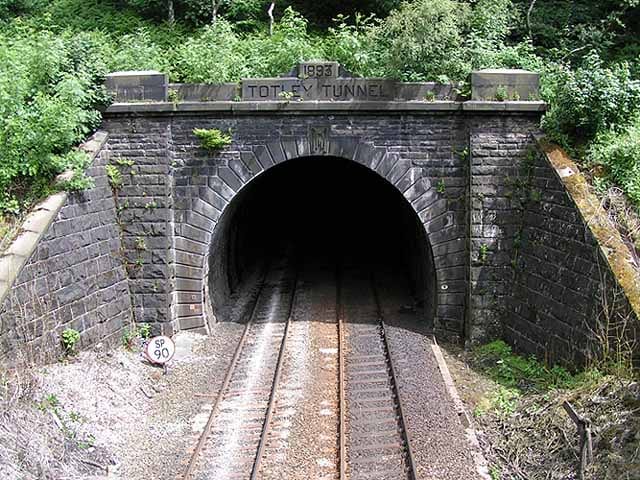
Photo: Dave.Dunford at English Wikipedia, Public domain, via Wikimedia Commons
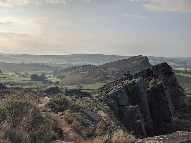
Photo: Alex Bishton, CC BY-SA 4.0, via Wikimedia Commons
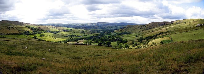
Photo: Vincent, Public domain, via Wikimedia Commons